Eldorado Bend Topo Map California
To zoom in, hover over the map of Eldorado Bend
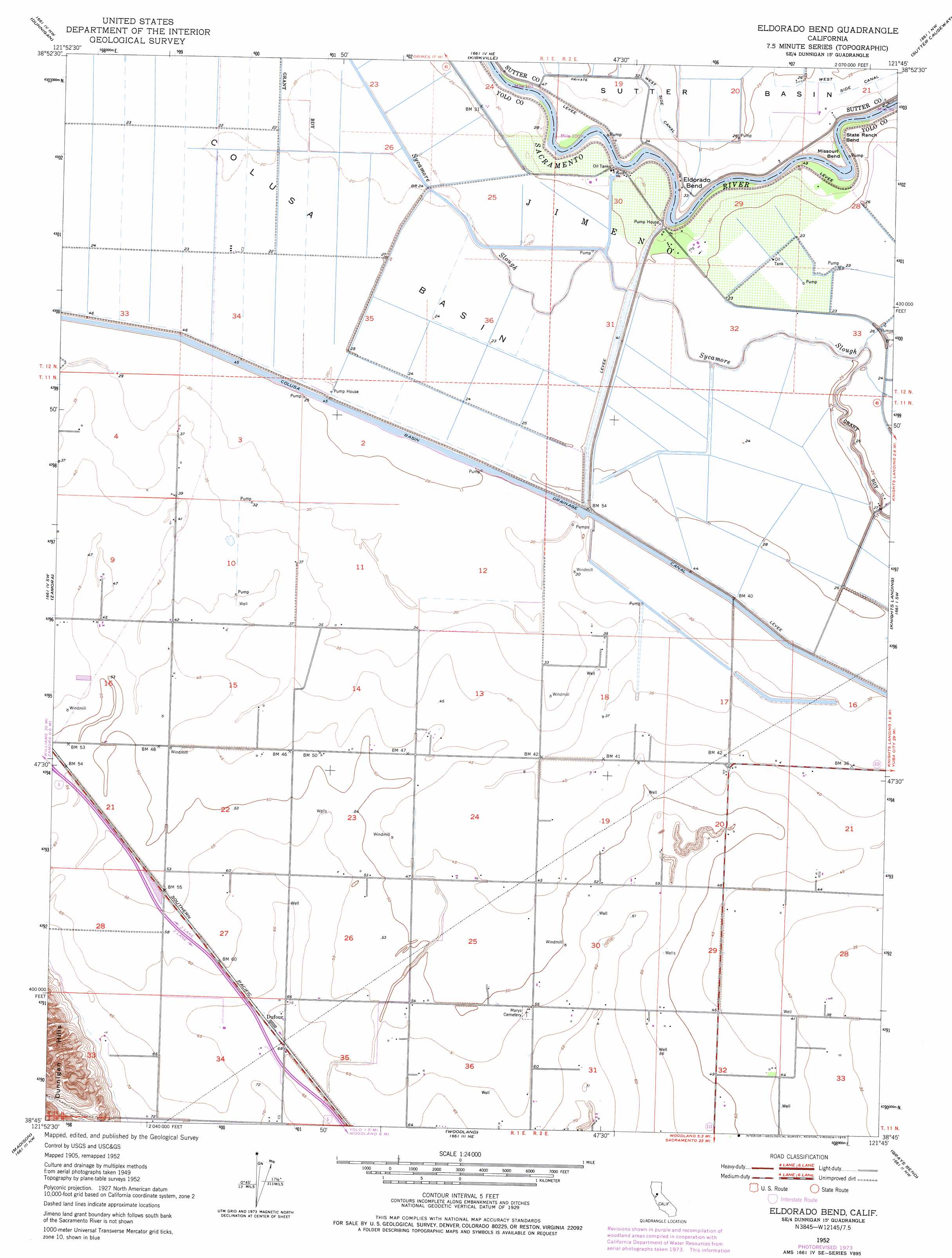
USGS Topo Quad 38121g7 - 1:24,000 scale
| Topo Map Name: | Eldorado Bend |
| USGS Topo Quad ID: | 38121g7 |
| Print Size: | ca. 21 1/4" wide x 27" high |
| Southeast Coordinates: | 38.75° N latitude / 121.75° W longitude |
| Map Center Coordinates: | 38.8125° N latitude / 121.8125° W longitude |
| U.S. State: | CA |
| Filename: | o38121g7.jpg |
| Download Map JPG Image: | Eldorado Bend topo map 1:24,000 scale |
| Map Type: | Topographic |
| Topo Series: | 7.5´ |
| Map Scale: | 1:24,000 |
| Source of Map Images: | United States Geological Survey (USGS) |
| Alternate Map Versions: |
Eldorado Bend CA 1952, updated 1953 Download PDF Buy paper map Eldorado Bend CA 1952, updated 1968 Download PDF Buy paper map Eldorado Bend CA 1952, updated 1968 Download PDF Buy paper map Eldorado Bend CA 1952, updated 1975 Download PDF Buy paper map Eldorado Bend CA 2012 Download PDF Buy paper map Eldorado Bend CA 2015 Download PDF Buy paper map |
1:24,000 Topo Quads surrounding Eldorado Bend
Arbuckle |
Grimes |
Tisdale Weir |
Gilsizer Slough |
Olivehurst |
Wildwood School |
Dunnigan |
Kirkville |
Sutter Causeway |
Nicolaus |
Bird Valley |
Zamora |
Eldorado Bend |
Knights Landing |
Verona |
Esparto |
Madison |
Woodland |
Grays Bend |
Taylor Monument |
Monticello Dam |
Winters |
Merritt |
Davis |
Sacramento West |
> Back to 38121e1 at 1:100,000 scale
> Back to 38120a1 at 1:250,000 scale
> Back to U.S. Topo Maps home
Eldorado Bend topo map: Gazetteer
Eldorado Bend: Bends
Eldorado Bend elevation 10m 32′Missouri Bend elevation 10m 32′
State Ranch Bend elevation 10m 32′
Eldorado Bend: Populated Places
Dufour elevation 21m 68′Ronda (historical) elevation 18m 59′
Eldorado Bend digital topo map on disk
Buy this Eldorado Bend topo map showing relief, roads, GPS coordinates and other geographical features, as a high-resolution digital map file on DVD: