Sutter Causeway Topo Map California
To zoom in, hover over the map of Sutter Causeway
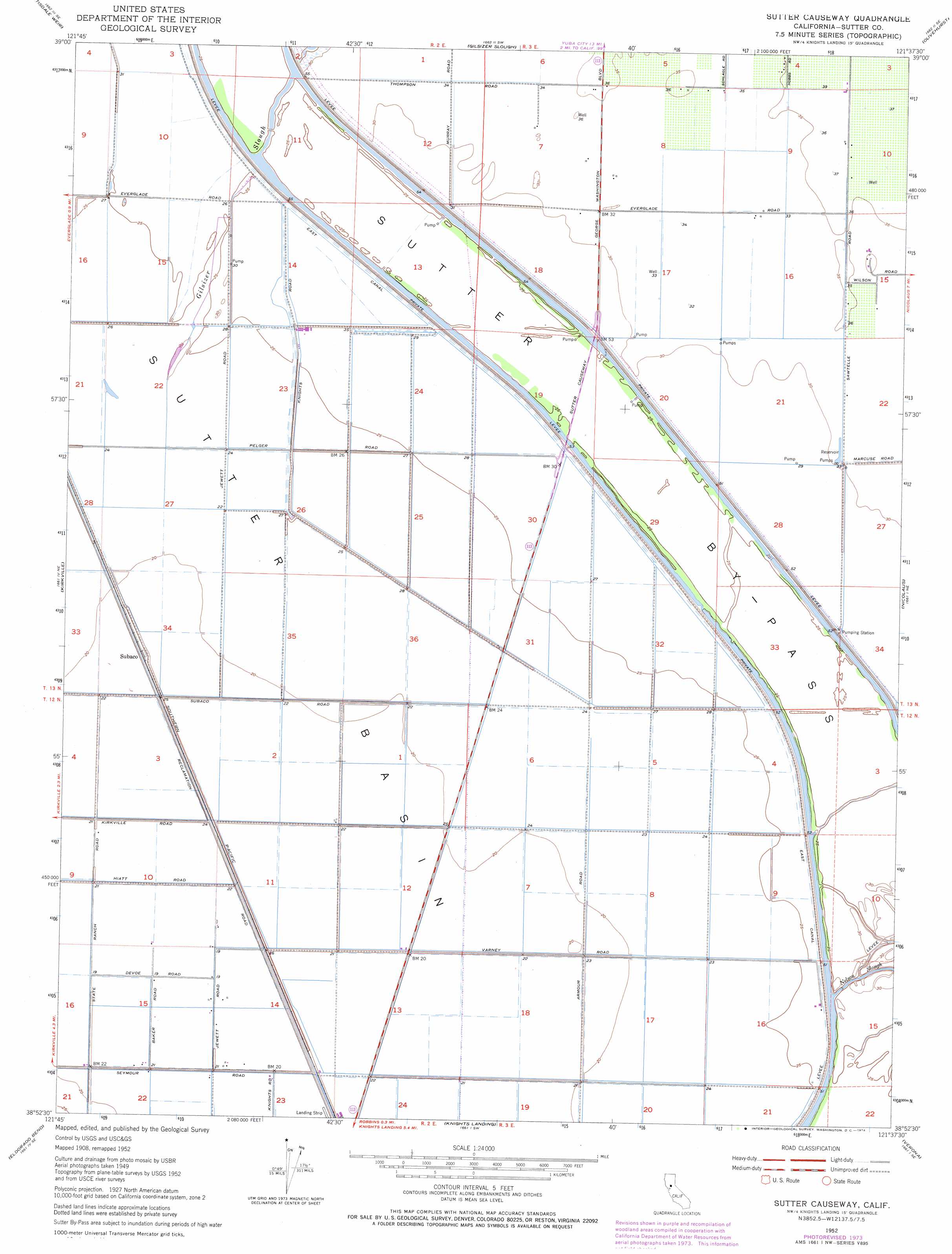
USGS Topo Quad 38121h6 - 1:24,000 scale
| Topo Map Name: | Sutter Causeway |
| USGS Topo Quad ID: | 38121h6 |
| Print Size: | ca. 21 1/4" wide x 27" high |
| Southeast Coordinates: | 38.875° N latitude / 121.625° W longitude |
| Map Center Coordinates: | 38.9375° N latitude / 121.6875° W longitude |
| U.S. State: | CA |
| Filename: | o38121h6.jpg |
| Download Map JPG Image: | Sutter Causeway topo map 1:24,000 scale |
| Map Type: | Topographic |
| Topo Series: | 7.5´ |
| Map Scale: | 1:24,000 |
| Source of Map Images: | United States Geological Survey (USGS) |
| Alternate Map Versions: |
Sutter Causeway CA 1952 Download PDF Buy paper map Sutter Causeway CA 1952, updated 1953 Download PDF Buy paper map Sutter Causeway CA 1952, updated 1974 Download PDF Buy paper map Sutter Causeway CA 1952, updated 1974 Download PDF Buy paper map Sutter Causeway CA 2012 Download PDF Buy paper map Sutter Causeway CA 2015 Download PDF Buy paper map |
1:24,000 Topo Quads surrounding Sutter Causeway
Meridian |
Sutter Buttes |
Sutter |
Yuba City |
Browns Valley |
Grimes |
Tisdale Weir |
Gilsizer Slough |
Olivehurst |
Wheatland |
Dunnigan |
Kirkville |
Sutter Causeway |
Nicolaus |
Sheridan |
Zamora |
Eldorado Bend |
Knights Landing |
Verona |
Pleasant Grove |
Madison |
Woodland |
Grays Bend |
Taylor Monument |
Rio Linda |
> Back to 38121e1 at 1:100,000 scale
> Back to 38120a1 at 1:250,000 scale
> Back to U.S. Topo Maps home
Sutter Causeway topo map: Gazetteer
Sutter Causeway: Basins
Sutter Basin elevation 7m 22′Sutter Causeway: Bridges
Sutter Causeway elevation 8m 26′Sutter Causeway: Canals
East Canal elevation 9m 29′Sutter Causeway: Populated Places
Marcuse (historical) elevation 11m 36′Subaco elevation 8m 26′
Wilson elevation 11m 36′
Sutter Causeway digital topo map on disk
Buy this Sutter Causeway topo map showing relief, roads, GPS coordinates and other geographical features, as a high-resolution digital map file on DVD: