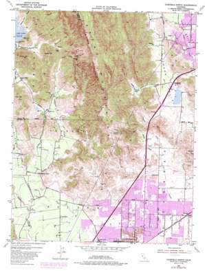
Fairfield North Topo Map California
To zoom in, hover over the map of Fairfield North
USGS Topo Quad 38122c1 - 1:24,000 scale
| Topo Map Name: | Fairfield North |
| USGS Topo Quad ID: | 38122c1 |
| Print Size: | ca. 21 1/4" wide x 27" high |
| Southeast Coordinates: | 38.25° N latitude / 122° W longitude |
| Map Center Coordinates: | 38.3125° N latitude / 122.0625° W longitude |
| U.S. State: | CA |
| Filename: | o38122c1.jpg |
| Download Map JPG Image: | Fairfield North topo map 1:24,000 scale |
| Map Type: | Topographic |
| Topo Series: | 7.5´ |
| Map Scale: | 1:24,000 |
| Source of Map Images: | United States Geological Survey (USGS) |
| Alternate Map Versions: |
Fairfield North CA 1951, updated 1952 Download PDF Buy paper map Fairfield North CA 1951, updated 1957 Download PDF Buy paper map Fairfield North CA 1951, updated 1968 Download PDF Buy paper map Fairfield North CA 1951, updated 1973 Download PDF Buy paper map Fairfield North CA 1951, updated 1977 Download PDF Buy paper map Fairfield North CA 1951, updated 1981 Download PDF Buy paper map Fairfield North CA 1951, updated 1985 Download PDF Buy paper map Fairfield North CA 2012 Download PDF Buy paper map Fairfield North CA 2015 Download PDF Buy paper map |
1:24,000 Topo Quads surrounding Fairfield North
> Back to 38122a1 at 1:100,000 scale
> Back to 38122a1 at 1:250,000 scale
> Back to U.S. Topo Maps home
Fairfield North topo map: Gazetteer
Fairfield North: Airports
Vacaville Airport elevation 66m 216′Fairfield North: Dams
Dickson Hill 1052 Dam elevation 55m 180′Gordon Valley Dam elevation 118m 387′
Lake Curry 14 Dam elevation 118m 387′
Olson 1410 Dam elevation 95m 311′
Pennsylvania Creek 1-033 Dam elevation 14m 45′
Fairfield North: Flats
Pumpkin Flat elevation 312m 1023′Fairfield North: Gaps
Pearl Gap elevation 183m 600′Fairfield North: Lakes
Lagoon elevation 63m 206′Fairfield North: Parks
Alamo Creek Park elevation 65m 213′Dover Park elevation 9m 29′
Hillview Park elevation 24m 78′
Laurel Creek Park elevation 23m 75′
Lee Bell Park elevation 8m 26′
Linear Park elevation 11m 36′
Mankas Park elevation 19m 62′
North Orchard Park elevation 68m 223′
Sunrise Park elevation 25m 82′
Tabor Park elevation 15m 49′
Veterans Park elevation 22m 72′
Wood Creek Park elevation 14m 45′
Fairfield North: Populated Places
Mankas Corner elevation 39m 127′Tolenas elevation 15m 49′
Fairfield North: Post Offices
Fairfield Post Office elevation 5m 16′Fairfield North: Reservoirs
Lake Curry elevation 118m 387′Fairfield North: Springs
Tolenas Springs elevation 212m 695′Fairfield North: Streams
Encinosa Creek elevation 63m 206′Gordon Valley Creek elevation 31m 101′
Laguna Creek elevation 55m 180′
McCoy Creek elevation 30m 98′
Soda Springs Creek elevation 35m 114′
Fairfield North: Summits
Bull Hill elevation 210m 688′Ephlin Hill elevation 291m 954′
Lemon Hill elevation 318m 1043′
Okell Hill elevation 342m 1122′
Fairfield North: Valleys
Bull Canyon elevation 118m 387′Cherry Glen elevation 77m 252′
Chimney Canyon elevation 117m 383′
Government Trail Canyon elevation 123m 403′
Lagoon Valley elevation 65m 213′
Seventy Acre Canyon elevation 118m 387′
Steele Canyon elevation 151m 495′
Stone Trough Canyon elevation 146m 479′
Suisun Valley elevation 27m 88′
Fairfield North digital topo map on disk
Buy this Fairfield North topo map showing relief, roads, GPS coordinates and other geographical features, as a high-resolution digital map file on DVD:


