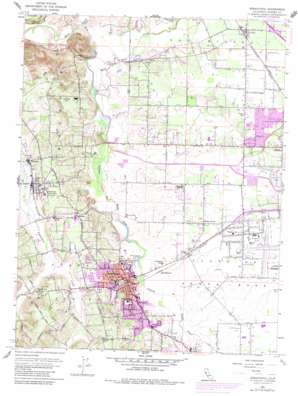
Sebastopol Topo Map California
To zoom in, hover over the map of Sebastopol
USGS Topo Quad 38122d7 - 1:24,000 scale
| Topo Map Name: | Sebastopol |
| USGS Topo Quad ID: | 38122d7 |
| Print Size: | ca. 21 1/4" wide x 27" high |
| Southeast Coordinates: | 38.375° N latitude / 122.75° W longitude |
| Map Center Coordinates: | 38.4375° N latitude / 122.8125° W longitude |
| U.S. State: | CA |
| Filename: | o38122d7.jpg |
| Download Map JPG Image: | Sebastopol topo map 1:24,000 scale |
| Map Type: | Topographic |
| Topo Series: | 7.5´ |
| Map Scale: | 1:24,000 |
| Source of Map Images: | United States Geological Survey (USGS) |
| Alternate Map Versions: |
Sebastopol CA 1954, updated 1955 Download PDF Buy paper map Sebastopol CA 1954, updated 1964 Download PDF Buy paper map Sebastopol CA 1954, updated 1969 Download PDF Buy paper map Sebastopol CA 1954, updated 1977 Download PDF Buy paper map Sebastopol CA 1954, updated 1980 Download PDF Buy paper map Sebastopol CA 1954, updated 1983 Download PDF Buy paper map Sebastopol CA 2012 Download PDF Buy paper map Sebastopol CA 2015 Download PDF Buy paper map |
1:24,000 Topo Quads surrounding Sebastopol
> Back to 38122a1 at 1:100,000 scale
> Back to 38122a1 at 1:250,000 scale
> Back to U.S. Topo Maps home
Sebastopol topo map: Gazetteer
Sebastopol: Airports
Santa Rosa Air Park (historical) elevation 31m 101′Sebastopol: Canals
Santa Rosa Flood Control Channel elevation 23m 75′Sebastopol: Dams
Pond Number 2 1050-002 Dam elevation 33m 108′Sebastopol: Parks
Brook Haven Park elevation 58m 190′Clahan Park elevation 19m 62′
Ives Park elevation 27m 88′
Live Oak Park elevation 30m 98′
Peterson Park elevation 34m 111′
Ragle Ranch Park elevation 46m 150′
Youth Community Park elevation 37m 121′
Sebastopol: Populated Places
Alten elevation 31m 101′Barlow elevation 39m 127′
Fulton elevation 41m 134′
Graton elevation 33m 108′
Gravenstein elevation 23m 75′
Hopyard (historical) elevation 33m 108′
Hurlbut elevation 58m 190′
Llano elevation 24m 78′
Manzana elevation 37m 121′
McCauley (historical) elevation 31m 101′
Mills elevation 58m 190′
Molino elevation 52m 170′
Monroe elevation 37m 121′
Riccas Corner elevation 29m 95′
Sebastopol elevation 25m 82′
Sousa Corners elevation 69m 226′
Trenton elevation 40m 131′
Woolsey elevation 28m 91′
Sebastopol: Post Offices
Carillo Post Office (historical) elevation 29m 95′Fulton Post Office elevation 42m 137′
Graton Post Office elevation 36m 118′
Sebastopol Post Office elevation 25m 82′
Sebastopol: Streams
Blucher Creek elevation 22m 72′Laguna de Santa Rosa elevation 14m 45′
Santa Rosa Creek elevation 15m 49′
Windsor Creek elevation 17m 55′
Sebastopol: Summits
Vine Hill elevation 105m 344′Sebastopol digital topo map on disk
Buy this Sebastopol topo map showing relief, roads, GPS coordinates and other geographical features, as a high-resolution digital map file on DVD:


