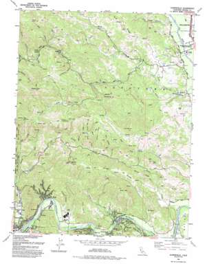
Guerneville Topo Map California
To zoom in, hover over the map of Guerneville
USGS Topo Quad 38122e8 - 1:24,000 scale
| Topo Map Name: | Guerneville |
| USGS Topo Quad ID: | 38122e8 |
| Print Size: | ca. 21 1/4" wide x 27" high |
| Southeast Coordinates: | 38.5° N latitude / 122.875° W longitude |
| Map Center Coordinates: | 38.5625° N latitude / 122.9375° W longitude |
| U.S. State: | CA |
| Filename: | o38122e8.jpg |
| Download Map JPG Image: | Guerneville topo map 1:24,000 scale |
| Map Type: | Topographic |
| Topo Series: | 7.5´ |
| Map Scale: | 1:24,000 |
| Source of Map Images: | United States Geological Survey (USGS) |
| Alternate Map Versions: |
Guerneville CA 1955, updated 1956 Download PDF Buy paper map Guerneville CA 1955, updated 1965 Download PDF Buy paper map Guerneville CA 1955, updated 1974 Download PDF Buy paper map Guerneville CA 1955, updated 1986 Download PDF Buy paper map Guerneville CA 1993, updated 1993 Download PDF Buy paper map Guerneville CA 1997, updated 1999 Download PDF Buy paper map Guerneville CA 2012 Download PDF Buy paper map Guerneville CA 2015 Download PDF Buy paper map |
1:24,000 Topo Quads surrounding Guerneville
> Back to 38122e1 at 1:100,000 scale
> Back to 38122a1 at 1:250,000 scale
> Back to U.S. Topo Maps home
Guerneville topo map: Gazetteer
Guerneville: Basins
Press Valley elevation 110m 360′Guerneville: Bridges
Guerneville Bridge elevation 5m 16′Guerneville: Flats
Bear Flat elevation 155m 508′The Meadows elevation 113m 370′
Guerneville: Gaps
Cedar Opening elevation 368m 1207′Pocket Opening elevation 493m 1617′
Scotts Opening elevation 313m 1026′
Guerneville: Mines
Sonoma Mine elevation 206m 675′Guerneville: Populated Places
El Bonita elevation 12m 39′Forest Hills elevation 23m 75′
Guerneville elevation 18m 59′
Hacienda elevation 56m 183′
Highcroft elevation 13m 42′
Hilton elevation 35m 114′
Hollydale elevation 110m 360′
Korbel elevation 29m 95′
Mount Jackson elevation 39m 127′
Odd Fellows Park elevation 64m 209′
Rio Nido elevation 23m 75′
Rolands elevation 27m 88′
Russian River Terrace elevation 71m 232′
Guerneville: Ridges
Brady Ridge elevation 226m 741′Denner Ridge elevation 175m 574′
Gilder Ridge elevation 273m 895′
Newgate Ridge elevation 318m 1043′
Scotts Ridge elevation 356m 1167′
Guerneville: Slopes
The Ladder elevation 286m 938′Guerneville: Springs
Buzzard Spring elevation 222m 728′Guerneville: Streams
Angel Creek elevation 169m 554′Boyd Creek elevation 195m 639′
Felta Creek elevation 32m 104′
Green Valley Creek elevation 13m 42′
Hobson Creek elevation 14m 45′
John Gordon Creek elevation 108m 354′
Osborne Creek elevation 148m 485′
Palmer Creek elevation 112m 367′
Porter Creek elevation 13m 42′
Press Creek elevation 79m 259′
Redwood Creek elevation 38m 124′
Scotts Creek elevation 126m 413′
Sweetwater Creek elevation 36m 118′
Wallace Creek elevation 196m 643′
Guerneville: Summits
Black Mountain elevation 401m 1315′Coyote Knoll elevation 199m 652′
McCray Mountain elevation 585m 1919′
Mount Jackson elevation 449m 1473′
Queens Peak elevation 584m 1916′
Rocky Mountain elevation 524m 1719′
Wild Hog Hill elevation 334m 1095′
Guerneville: Trails
East Ridge Trail elevation 112m 367′Guerneville: Valleys
Coldwater Gulch elevation 151m 495′Fox Canyon elevation 90m 295′
Pasquini Canyon elevation 25m 82′
Pickle Canyon elevation 222m 728′
Pine Ridge Canyon elevation 35m 114′
Renevar Gulch elevation 144m 472′
Guerneville digital topo map on disk
Buy this Guerneville topo map showing relief, roads, GPS coordinates and other geographical features, as a high-resolution digital map file on DVD:


