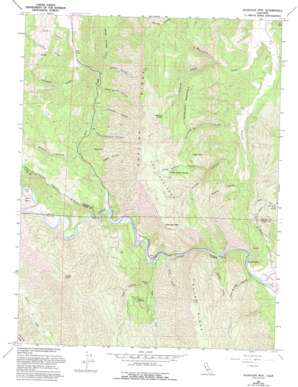
Glascock Mountain Topo Map California
To zoom in, hover over the map of Glascock Mountain
USGS Topo Quad 38122h3 - 1:24,000 scale
| Topo Map Name: | Glascock Mountain |
| USGS Topo Quad ID: | 38122h3 |
| Print Size: | ca. 21 1/4" wide x 27" high |
| Southeast Coordinates: | 38.875° N latitude / 122.25° W longitude |
| Map Center Coordinates: | 38.9375° N latitude / 122.3125° W longitude |
| U.S. State: | CA |
| Filename: | o38122h3.jpg |
| Download Map JPG Image: | Glascock Mountain topo map 1:24,000 scale |
| Map Type: | Topographic |
| Topo Series: | 7.5´ |
| Map Scale: | 1:24,000 |
| Source of Map Images: | United States Geological Survey (USGS) |
| Alternate Map Versions: |
Glascock Mtn CA 1958, updated 1961 Download PDF Buy paper map Glascock Mtn CA 1958, updated 1965 Download PDF Buy paper map Glascock Mtn CA 1958, updated 1990 Download PDF Buy paper map Glascock Mtn CA 1958, updated 1993 Download PDF Buy paper map Glascock Mountain CA 2012 Download PDF Buy paper map Glascock Mountain CA 2015 Download PDF Buy paper map |
1:24,000 Topo Quads surrounding Glascock Mountain
> Back to 38122e1 at 1:100,000 scale
> Back to 38122a1 at 1:250,000 scale
> Back to U.S. Topo Maps home
Glascock Mountain topo map: Gazetteer
Glascock Mountain: Areas
The Redlands elevation 686m 2250′Glascock Mountain: Flats
Buck Flats elevation 240m 787′Glascock Mountain: Islands
Buck Island elevation 300m 984′Glascock Mountain: Parks
Cache Creek Regional Park elevation 273m 895′Glascock Mountain: Springs
Cold Spring elevation 317m 1040′Glascock Spring elevation 602m 1975′
Little Sulphur Spring elevation 618m 2027′
Sulphur Spring elevation 448m 1469′
Glascock Mountain: Streams
Bear Creek elevation 193m 633′Fiske Creek elevation 170m 557′
Olgert Canyon elevation 221m 725′
Glascock Mountain: Summits
Anderson Mountain elevation 579m 1899′Billys Hill elevation 524m 1719′
Glascock Mountain elevation 733m 2404′
Langs Peak elevation 809m 2654′
Lytle Mountain elevation 636m 2086′
Glascock Mountain: Valleys
Bear Canyon elevation 219m 718′Brophy Canyon elevation 232m 761′
Bullshead Canyon elevation 205m 672′
Craig Canyon elevation 307m 1007′
Eula Canyon elevation 317m 1040′
Glascock Canyon elevation 271m 889′
Holsten Canyon elevation 274m 898′
Holsten Chimney Canyon elevation 252m 826′
Lawson Canyon elevation 302m 990′
Little Sulphur Canyon elevation 414m 1358′
Palmer Canyon elevation 280m 918′
Pocket Canyon elevation 215m 705′
Pocket Gulch elevation 160m 524′
Pole Bridge Canyon elevation 139m 456′
Rumsey Canyon elevation 148m 485′
Shale Spring Canyon elevation 296m 971′
South Jackson Canyon elevation 307m 1007′
Still Gulch elevation 171m 561′
Thompson Canyon elevation 287m 941′
Glascock Mountain digital topo map on disk
Buy this Glascock Mountain topo map showing relief, roads, GPS coordinates and other geographical features, as a high-resolution digital map file on DVD:


