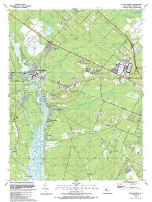
Mays Landing Topo Map New Jersey
To zoom in, hover over the map of Mays Landing
USGS Topo Quad 39074d6 - 1:24,000 scale
| Topo Map Name: | Mays Landing |
| USGS Topo Quad ID: | 39074d6 |
| Print Size: | ca. 21 1/4" wide x 27" high |
| Southeast Coordinates: | 39.375° N latitude / 74.625° W longitude |
| Map Center Coordinates: | 39.4375° N latitude / 74.6875° W longitude |
| U.S. State: | NJ |
| Filename: | o39074d6.jpg |
| Download Map JPG Image: | Mays Landing topo map 1:24,000 scale |
| Map Type: | Topographic |
| Topo Series: | 7.5´ |
| Map Scale: | 1:24,000 |
| Source of Map Images: | United States Geological Survey (USGS) |
| Alternate Map Versions: |
Mays Landing NJ 1955, updated 1956 Download PDF Buy paper map Mays Landing NJ 1955, updated 1965 Download PDF Buy paper map Mays Landing NJ 1955, updated 1973 Download PDF Buy paper map Mays Landing NJ 1989, updated 1989 Download PDF Buy paper map Mays Landing NJ 1995, updated 2000 Download PDF Buy paper map Mays Landing NJ 2011 Download PDF Buy paper map Mays Landing NJ 2014 Download PDF Buy paper map Mays Landing NJ 2016 Download PDF Buy paper map |
1:24,000 Topo Quads surrounding Mays Landing
> Back to 39074a1 at 1:100,000 scale
> Back to 39074a1 at 1:250,000 scale
> Back to U.S. Topo Maps home
Mays Landing topo map: Gazetteer
Mays Landing: Airports
Atlantic Blueberry Company Airstrip elevation 7m 22′Davis Field elevation 7m 22′
Strawberry Fields Airport elevation 13m 42′
Mays Landing: Crossings
Interchange 24 elevation 21m 68′Mays Landing: Dams
Lake Lenape Dam elevation 0m 0′Stephen Lake Dam elevation 5m 16′
Mays Landing: Lakes
Lake Lenape elevation 3m 9′Mays Landing: Parks
Atlantic County Park elevation 3m 9′Pine Oak Park elevation 17m 55′
Mays Landing: Populated Places
Belcoville elevation 3m 9′Catawba elevation 4m 13′
Clarkstown elevation 3m 9′
Clover Leaf Lakes elevation 9m 29′
Estell Manor elevation 7m 22′
Estellville elevation 6m 19′
Gravelly Run elevation 6m 19′
High Bank Landing elevation 1m 3′
Laureldale elevation 18m 59′
Mays Landing elevation 5m 16′
McKee City elevation 21m 68′
Reega elevation 15m 49′
Steelman Landing elevation 0m 0′
Thelma elevation 14m 45′
Thompsontown elevation 4m 13′
Wilsons Landing elevation 1m 3′
Mays Landing: Post Offices
Mays Landing Post Office elevation 6m 19′Mays Landing: Reservoirs
Stephen Lake elevation 5m 16′Mays Landing: Streams
Adams Branch elevation 10m 32′Babcock Creek elevation 1m 3′
Cedar Branch elevation 1m 3′
Cedar Branch elevation 2m 6′
Dry Run elevation 4m 13′
Gravelly Run elevation 0m 0′
Jack Pudding Branch elevation 10m 32′
Man Killer Branch elevation 10m 32′
Miry Run elevation 1m 3′
Perch Cove Run elevation 0m 0′
South River elevation 1m 3′
Watering Race Branch elevation 1m 3′
Mays Landing: Swamps
Babcock Swamp elevation 10m 32′Mays Landing digital topo map on disk
Buy this Mays Landing topo map showing relief, roads, GPS coordinates and other geographical features, as a high-resolution digital map file on DVD:
Atlantic Coast (NY, NJ, PA, DE, MD, VA, NC)
Buy digital topo maps: Atlantic Coast (NY, NJ, PA, DE, MD, VA, NC)


