Dorothy Topo Map New Jersey
To zoom in, hover over the map of Dorothy
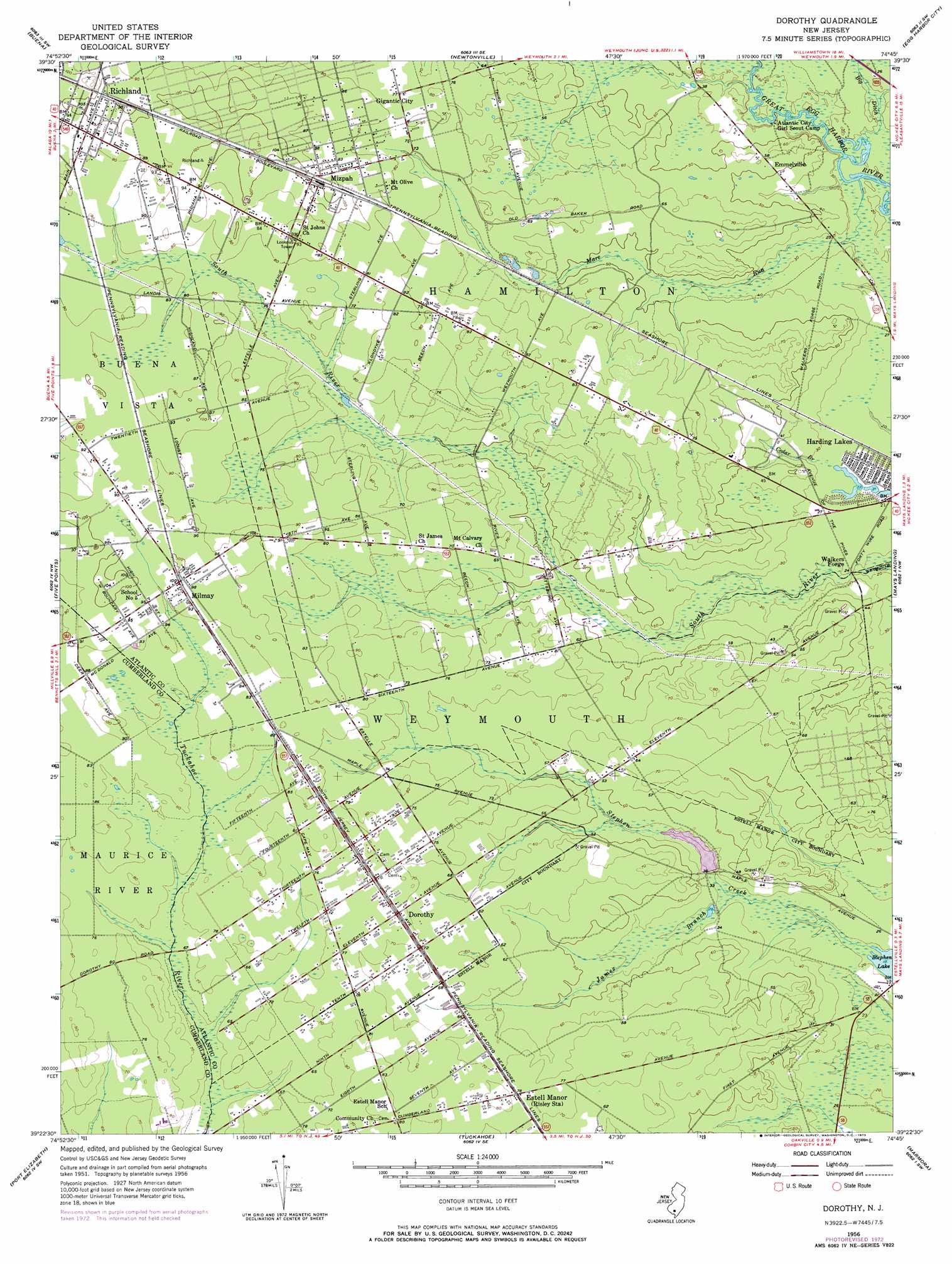
USGS Topo Quad 39074d7 - 1:24,000 scale
| Topo Map Name: | Dorothy |
| USGS Topo Quad ID: | 39074d7 |
| Print Size: | ca. 21 1/4" wide x 27" high |
| Southeast Coordinates: | 39.375° N latitude / 74.75° W longitude |
| Map Center Coordinates: | 39.4375° N latitude / 74.8125° W longitude |
| U.S. State: | NJ |
| Filename: | o39074d7.jpg |
| Download Map JPG Image: | Dorothy topo map 1:24,000 scale |
| Map Type: | Topographic |
| Topo Series: | 7.5´ |
| Map Scale: | 1:24,000 |
| Source of Map Images: | United States Geological Survey (USGS) |
| Alternate Map Versions: |
Dorothy NJ 1956, updated 1957 Download PDF Buy paper map Dorothy NJ 1956, updated 1967 Download PDF Buy paper map Dorothy NJ 1956, updated 1973 Download PDF Buy paper map Dorothy NJ 1956, updated 1973 Download PDF Buy paper map Dorothy NJ 1994, updated 1998 Download PDF Buy paper map Dorothy NJ 2011 Download PDF Buy paper map Dorothy NJ 2014 Download PDF Buy paper map Dorothy NJ 2016 Download PDF Buy paper map |
1:24,000 Topo Quads surrounding Dorothy
Pitman East |
Williamstown |
Hammonton |
Atsion |
Jenkins |
Newfield |
Buena |
Newtonville |
Egg Harbor City |
Green Bank |
Millville |
Five Points |
Dorothy |
Mays Landing |
Pleasantville |
Dividing Creek |
Port Elizabeth |
Tuckahoe |
Marmora |
Ocean City |
Port Norris |
Heislerville |
Woodbine |
Sea Isle City |
> Back to 39074a1 at 1:100,000 scale
> Back to 39074a1 at 1:250,000 scale
> Back to U.S. Topo Maps home
Dorothy topo map: Gazetteer
Dorothy: Dams
Maple Lake Dam elevation 9m 29′Dorothy: Populated Places
Dorothy elevation 22m 72′Doughty elevation 28m 91′
Emmelsville elevation 16m 52′
Gigantic City elevation 23m 75′
Harding Lakes elevation 6m 19′
Milmay elevation 29m 95′
Mizpah elevation 28m 91′
Richland elevation 29m 95′
Walkers Forge elevation 6m 19′
Dorothy: Reservoirs
Maple Lake elevation 9m 29′Dorothy: Streams
James Branch elevation 8m 26′Mare Run elevation 6m 19′
Dorothy digital topo map on disk
Buy this Dorothy topo map showing relief, roads, GPS coordinates and other geographical features, as a high-resolution digital map file on DVD:
Atlantic Coast (NY, NJ, PA, DE, MD, VA, NC)
Buy digital topo maps: Atlantic Coast (NY, NJ, PA, DE, MD, VA, NC)
 map DVD")