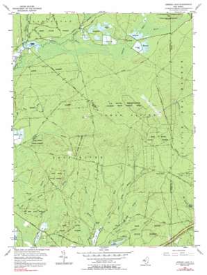
Oswego Lake Topo Map New Jersey
To zoom in, hover over the map of Oswego Lake
USGS Topo Quad 39074f4 - 1:24,000 scale
| Topo Map Name: | Oswego Lake |
| USGS Topo Quad ID: | 39074f4 |
| Print Size: | ca. 21 1/4" wide x 27" high |
| Southeast Coordinates: | 39.625° N latitude / 74.375° W longitude |
| Map Center Coordinates: | 39.6875° N latitude / 74.4375° W longitude |
| U.S. State: | NJ |
| Filename: | o39074f4.jpg |
| Download Map JPG Image: | Oswego Lake topo map 1:24,000 scale |
| Map Type: | Topographic |
| Topo Series: | 7.5´ |
| Map Scale: | 1:24,000 |
| Source of Map Images: | United States Geological Survey (USGS) |
| Alternate Map Versions: |
Oswego Lake NJ 1955, updated 1956 Download PDF Buy paper map Oswego Lake NJ 1955, updated 1961 Download PDF Buy paper map Oswego Lake NJ 1955, updated 1968 Download PDF Buy paper map Oswego Lake NJ 1955, updated 1992 Download PDF Buy paper map Oswego Lake NJ 1997, updated 1998 Download PDF Buy paper map Oswego Lake NJ 2011 Download PDF Buy paper map Oswego Lake NJ 2014 Download PDF Buy paper map Oswego Lake NJ 2016 Download PDF Buy paper map |
1:24,000 Topo Quads surrounding Oswego Lake
> Back to 39074e1 at 1:100,000 scale
> Back to 39074a1 at 1:250,000 scale
> Back to U.S. Topo Maps home
Oswego Lake topo map: Gazetteer
Oswego Lake: Bridges
Bartletts Bridge elevation 6m 19′Dans Bridge elevation 5m 16′
Oswego Lake: Dams
Lake Absegami Dam elevation 3m 9′Oswego Dam elevation 16m 52′
Oswego Lake: Flats
Lower Plains elevation 38m 124′Oswego Lake: Forests
Bass River State Forest elevation 12m 39′Penn State Forest elevation 21m 68′
Oswego Lake: Populated Places
Munion Field elevation 19m 62′Penn Place elevation 21m 68′
Sim Place elevation 27m 88′
Oswego Lake: Reservoirs
Lake Absegami elevation 3m 9′Oswego Lake elevation 14m 45′
Oswego Lake: Streams
Bartletts Branch elevation 6m 19′Breeches Branch elevation 15m 49′
Dans Bridge Branch elevation 4m 13′
Dry Branch elevation 27m 88′
Papoose Branch elevation 18m 59′
Plains Branch elevation 25m 82′
Tommys Branch elevation 5m 16′
Oswego Lake digital topo map on disk
Buy this Oswego Lake topo map showing relief, roads, GPS coordinates and other geographical features, as a high-resolution digital map file on DVD:
Atlantic Coast (NY, NJ, PA, DE, MD, VA, NC)
Buy digital topo maps: Atlantic Coast (NY, NJ, PA, DE, MD, VA, NC)


