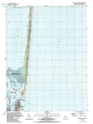
Barnegat Light Topo Map New Jersey
To zoom in, hover over the map of Barnegat Light
USGS Topo Quad 39074g1 - 1:24,000 scale
| Topo Map Name: | Barnegat Light |
| USGS Topo Quad ID: | 39074g1 |
| Print Size: | ca. 21 1/4" wide x 27" high |
| Southeast Coordinates: | 39.75° N latitude / 74° W longitude |
| Map Center Coordinates: | 39.8125° N latitude / 74.0625° W longitude |
| U.S. State: | NJ |
| Filename: | o39074g1.jpg |
| Download Map JPG Image: | Barnegat Light topo map 1:24,000 scale |
| Map Type: | Topographic |
| Topo Series: | 7.5´ |
| Map Scale: | 1:24,000 |
| Source of Map Images: | United States Geological Survey (USGS) |
| Alternate Map Versions: |
Barnegat Light NJ 1953, updated 1957 Download PDF Buy paper map Barnegat Light NJ 1953, updated 1964 Download PDF Buy paper map Barnegat Light NJ 1953, updated 1973 Download PDF Buy paper map Barnegat Light NJ 1989, updated 1989 Download PDF Buy paper map Barnegat Light NJ 1989, updated 1989 Download PDF Buy paper map Barnegat Light NJ 2011 Download PDF Buy paper map Barnegat Light NJ 2014 Download PDF Buy paper map Barnegat Light NJ 2016 Download PDF Buy paper map |
1:24,000 Topo Quads surrounding Barnegat Light
Lakehurst |
Lakewood |
Point Pleasant |
||
Keswick Grove |
Toms River |
Seaside Park |
||
Brookville |
Forked River |
Barnegat Light |
||
West Creek |
Ship Bottom |
Long Beach Ne |
||
Tuckerton |
Beach Haven |
> Back to 39074e1 at 1:100,000 scale
> Back to 39074a1 at 1:250,000 scale
> Back to U.S. Topo Maps home
Barnegat Light topo map: Gazetteer
Barnegat Light: Airports
Barnegat elevation 2m 6′Barnegat Light: Bars
The Dike elevation 1m 3′Tices Shoal elevation 0m 0′
Barnegat Light: Bays
Johnny Allens Cove elevation 0m 0′Barnegat Light: Beaches
Island Beach elevation 0m 0′Long Beach elevation 1m 3′
Barnegat Light: Channels
Barnegat Inlet elevation 0m 0′Barnegat Light: Islands
Sedge Islands elevation 0m 0′Barnegat Light: Parks
Barnegat Lighthouse State Park elevation 8m 26′Island Beach State Park elevation 2m 6′
Sedge Islands State Wildlife Management Area elevation 1m 3′
Barnegat Light: Populated Places
Barnegat Light elevation 2m 6′Barnegat Light: Post Offices
Barnegat Light Post Office elevation 2m 6′Barnegat Light digital topo map on disk
Buy this Barnegat Light topo map showing relief, roads, GPS coordinates and other geographical features, as a high-resolution digital map file on DVD:
Atlantic Coast (NY, NJ, PA, DE, MD, VA, NC)
Buy digital topo maps: Atlantic Coast (NY, NJ, PA, DE, MD, VA, NC)


