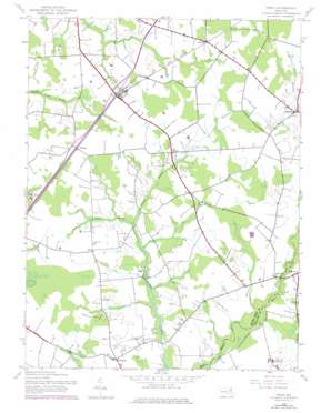
Price Topo Map Maryland
To zoom in, hover over the map of Price
USGS Topo Quad 39075a8 - 1:24,000 scale
| Topo Map Name: | Price |
| USGS Topo Quad ID: | 39075a8 |
| Print Size: | ca. 21 1/4" wide x 27" high |
| Southeast Coordinates: | 39° N latitude / 75.875° W longitude |
| Map Center Coordinates: | 39.0625° N latitude / 75.9375° W longitude |
| U.S. State: | MD |
| Filename: | o39075a8.jpg |
| Download Map JPG Image: | Price topo map 1:24,000 scale |
| Map Type: | Topographic |
| Topo Series: | 7.5´ |
| Map Scale: | 1:24,000 |
| Source of Map Images: | United States Geological Survey (USGS) |
| Alternate Map Versions: |
Price MD 1944, updated 1961 Download PDF Buy paper map Price MD 1944, updated 1969 Download PDF Buy paper map Price MD 1944, updated 1976 Download PDF Buy paper map Price MD 2011 Download PDF Buy paper map Price MD 2014 Download PDF Buy paper map Price MD 2017 Download PDF Buy paper map |
1:24,000 Topo Quads surrounding Price
> Back to 39075a1 at 1:100,000 scale
> Back to 39074a1 at 1:250,000 scale
> Back to U.S. Topo Maps home
Price topo map: Gazetteer
Price: Bridges
Clucktown Bridge elevation 12m 39′Clucktown Bridge elevation 12m 39′
German Branch Bridge elevation 12m 39′
Mason Bridge elevation 9m 29′
Mason Bridge elevation 9m 29′
Price: Parks
Tuckahoe State Park elevation 10m 32′Price: Populated Places
Deans Meadows elevation 12m 39′Hayden elevation 20m 65′
Hope elevation 20m 65′
Ingleside elevation 18m 59′
Lyn Woods elevation 12m 39′
Lynn Woods elevation 13m 42′
Price elevation 20m 65′
Roberts elevation 20m 65′
Roe elevation 20m 65′
Ruthsburg elevation 20m 65′
The Plains elevation 18m 59′
Price: Post Offices
Ingleside Post Office elevation 18m 59′Price Post Office elevation 20m 65′
Price: Streams
Wildcat Branch elevation 12m 39′Price digital topo map on disk
Buy this Price topo map showing relief, roads, GPS coordinates and other geographical features, as a high-resolution digital map file on DVD:
Atlantic Coast (NY, NJ, PA, DE, MD, VA, NC)
Buy digital topo maps: Atlantic Coast (NY, NJ, PA, DE, MD, VA, NC)


