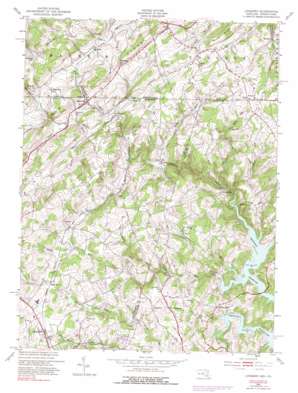
Lineboro Topo Map Maryland
To zoom in, hover over the map of Lineboro
USGS Topo Quad 39076f7 - 1:24,000 scale
| Topo Map Name: | Lineboro |
| USGS Topo Quad ID: | 39076f7 |
| Print Size: | ca. 21 1/4" wide x 27" high |
| Southeast Coordinates: | 39.625° N latitude / 76.75° W longitude |
| Map Center Coordinates: | 39.6875° N latitude / 76.8125° W longitude |
| U.S. States: | MD, PA |
| Filename: | o39076f7.jpg |
| Download Map JPG Image: | Lineboro topo map 1:24,000 scale |
| Map Type: | Topographic |
| Topo Series: | 7.5´ |
| Map Scale: | 1:24,000 |
| Source of Map Images: | United States Geological Survey (USGS) |
| Alternate Map Versions: |
Lineboro MD 1953, updated 1954 Download PDF Buy paper map Lineboro MD 1953, updated 1954 Download PDF Buy paper map Lineboro MD 1953, updated 1966 Download PDF Buy paper map Lineboro MD 1953, updated 1975 Download PDF Buy paper map Lineboro MD 1953, updated 1984 Download PDF Buy paper map Lineboro MD 1953, updated 1991 Download PDF Buy paper map Lineboro MD 2011 Download PDF Buy paper map Lineboro MD 2014 Download PDF Buy paper map Lineboro MD 2016 Download PDF Buy paper map |
1:24,000 Topo Quads surrounding Lineboro
> Back to 39076e1 at 1:100,000 scale
> Back to 39076a1 at 1:250,000 scale
> Back to U.S. Topo Maps home
Lineboro topo map: Gazetteer
Lineboro: Basins
Fairs Valley elevation 234m 767′Lineboro: Populated Places
Albantown elevation 240m 787′Alesia elevation 223m 731′
Alesia Heights elevation 251m 823′
Beckleysville elevation 196m 643′
Blackrock elevation 239m 784′
Boones Meadows elevation 255m 836′
Breezy Hill Estates elevation 242m 793′
Brothers Delight elevation 270m 885′
Donney Brook Farms elevation 220m 721′
Fairmount North elevation 248m 813′
Fiscal elevation 274m 898′
Forest Knoll elevation 270m 885′
Foreston Ridge Estates elevation 209m 685′
Greenmount elevation 249m 816′
Gross Mill Estates elevation 210m 688′
Gunpowder Acres elevation 256m 839′
Gunpowder Ridge elevation 235m 770′
Happy Valley elevation 264m 866′
Hildebrand elevation 222m 728′
Hi-View Estates elevation 262m 859′
Hoffmanville elevation 220m 721′
Hokes elevation 241m 790′
Hollinsland elevation 207m 679′
Hunt Ridge elevation 247m 810′
Klein Estates elevation 289m 948′
Leatherwood elevation 208m 682′
Lincoln Manor elevation 231m 757′
Lineboro elevation 210m 688′
Maple Grove elevation 249m 816′
Mason Dixon Estates elevation 263m 862′
Middletown Downs elevation 259m 849′
Middletown Estates elevation 260m 853′
Mikules Manor elevation 261m 856′
Mill Stream Hills elevation 204m 669′
Millers elevation 249m 816′
Millwood elevation 252m 826′
North Carroll Farms elevation 250m 820′
Peaceful Valley elevation 239m 784′
Prettyboy Trails elevation 216m 708′
Resh Mill Farms elevation 240m 787′
Rockbrook Trailer Park elevation 232m 761′
Rockbrook Village elevation 230m 754′
Rockdale elevation 180m 590′
Roller elevation 183m 600′
Rolling Falls Estates elevation 220m 721′
Saint Pauls elevation 251m 823′
Seven Havens elevation 247m 810′
Smithtown Ridge elevation 252m 826′
Sticks elevation 258m 846′
Stiltz elevation 294m 964′
Sugar Valley elevation 258m 846′
Sunset Way elevation 239m 784′
Treelin Manor elevation 257m 843′
Valley Vista elevation 235m 770′
Vangline Acres elevation 262m 859′
Walbrook Manor elevation 235m 770′
Walkers Run elevation 269m 882′
Webers Ridge elevation 253m 830′
Wil-Mar Acres elevation 249m 816′
Wine Bel Valley elevation 220m 721′
Young Mans Fancy elevation 238m 780′
Lineboro: Post Offices
Krohs Mill Post Office (historical) elevation 210m 688′Lineboro Post Office elevation 208m 682′
Millers Post Office elevation 256m 839′
Lineboro: Reservoirs
North Carroll Community Pond elevation 272m 892′Lineboro: Ridges
Dug Hill Ridge elevation 287m 941′Lineboro: Springs
Lineboro Spring elevation 242m 793′Lineboro: Streams
Compass Run elevation 158m 518′Dykes Creek elevation 162m 531′
Georges Run elevation 158m 518′
Grave Run elevation 158m 518′
Indian Run elevation 192m 629′
Muddy Creek elevation 181m 593′
Poplar Run elevation 158m 518′
Silver Run elevation 159m 521′
South Branch Gunpowder Falls elevation 199m 652′
Walker Run elevation 164m 538′
Lineboro: Summits
Beecher Hill elevation 324m 1062′Lineboro digital topo map on disk
Buy this Lineboro topo map showing relief, roads, GPS coordinates and other geographical features, as a high-resolution digital map file on DVD:
Atlantic Coast (NY, NJ, PA, DE, MD, VA, NC)
Buy digital topo maps: Atlantic Coast (NY, NJ, PA, DE, MD, VA, NC)


