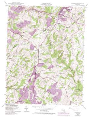
Damascus Topo Map Maryland
To zoom in, hover over the map of Damascus
USGS Topo Quad 39077c2 - 1:24,000 scale
| Topo Map Name: | Damascus |
| USGS Topo Quad ID: | 39077c2 |
| Print Size: | ca. 21 1/4" wide x 27" high |
| Southeast Coordinates: | 39.25° N latitude / 77.125° W longitude |
| Map Center Coordinates: | 39.3125° N latitude / 77.1875° W longitude |
| U.S. State: | MD |
| Filename: | o39077c2.jpg |
| Download Map JPG Image: | Damascus topo map 1:24,000 scale |
| Map Type: | Topographic |
| Topo Series: | 7.5´ |
| Map Scale: | 1:24,000 |
| Source of Map Images: | United States Geological Survey (USGS) |
| Alternate Map Versions: |
Damascus MD 1944, updated 1962 Download PDF Buy paper map Damascus MD 1944, updated 1966 Download PDF Buy paper map Damascus MD 1944, updated 1971 Download PDF Buy paper map Damascus MD 1944, updated 1975 Download PDF Buy paper map Damascus MD 1944, updated 1979 Download PDF Buy paper map Damascus MD 1950 Download PDF Buy paper map Damascus MD 1950 Download PDF Buy paper map Damascus MD 1981, updated 1986 Download PDF Buy paper map Damascus MD 2011 Download PDF Buy paper map Damascus MD 2014 Download PDF Buy paper map Damascus MD 2016 Download PDF Buy paper map |
1:24,000 Topo Quads surrounding Damascus
> Back to 39077a1 at 1:100,000 scale
> Back to 39076a1 at 1:250,000 scale
> Back to U.S. Topo Maps home
Damascus topo map: Gazetteer
Damascus: Crossings
Interchange 68 elevation 254m 833′Damascus: Dams
Saint Clair Farm Pond Dam elevation 175m 574′Damascus: Parks
Damascus Park elevation 243m 797′Great Seneca Stream Valley Park Unit 9 elevation 195m 639′
John Haines Park elevation 231m 757′
Kempton Community Park elevation 197m 646′
Mount Airy Carnival Grounds elevation 239m 784′
Moyer Road Park elevation 226m 741′
Oak Ridge Conservation Park elevation 210m 688′
Upper Magruder Branch Park elevation 197m 646′
Damascus: Populated Places
Annapolis Rock elevation 164m 538′Ashley Acres elevation 189m 620′
Bartholows elevation 159m 521′
Bennett Manor elevation 255m 836′
Bicentennial Estates elevation 224m 734′
Bootjack elevation 188m 616′
Bradford Estates elevation 212m 695′
Browningsville elevation 155m 508′
Cedar Grove Knolls elevation 223m 731′
Cedar Heights elevation 246m 807′
Cedar Heights Estates elevation 217m 711′
Chesney elevation 222m 728′
Claggettsville elevation 226m 741′
Clearspring Manor elevation 238m 780′
Conestoga Heights elevation 224m 734′
Country View elevation 241m 790′
County View elevation 236m 774′
Damascus elevation 264m 866′
Damascus Gardens elevation 240m 787′
Damascus Hill elevation 208m 682′
Damascus Manor elevation 245m 803′
Damascus Terrace elevation 242m 793′
Damascus Valley Estates elevation 236m 774′
Damascus Valley Park elevation 234m 767′
Damascus View elevation 248m 813′
Davis elevation 250m 820′
Dendor Mar Estates elevation 210m 688′
Diamond View elevation 220m 721′
Duvall Manor elevation 225m 738′
East Rolling Hills elevation 259m 849′
Etchison elevation 194m 636′
Farmfield Estates elevation 211m 692′
Florence Estates elevation 205m 672′
Four County Farm elevation 259m 849′
Fox Ridge Estates elevation 234m 767′
Fremont Acres elevation 206m 675′
Friendship elevation 236m 774′
Friendship Knolls elevation 233m 764′
Greenhills elevation 207m 679′
Hanford Estates elevation 220m 721′
Harmony Hall elevation 236m 774′
Harvest Ridge elevation 199m 652′
Hawthorne Acres elevation 197m 646′
Hickory Hill elevation 247m 810′
Hickory Ridge elevation 198m 649′
Highview elevation 214m 702′
Hungerford Manor elevation 165m 541′
Janwood elevation 200m 656′
Kelly Ridge elevation 197m 646′
Kemptown elevation 223m 731′
Kings Valley elevation 182m 597′
Kings Valley Manor elevation 231m 757′
Kingstead Knolls elevation 233m 764′
Kittyhawk Estates elevation 207m 679′
Langdon Woods elevation 262m 859′
Linganore View elevation 190m 623′
Long Corner elevation 247m 810′
Merridale elevation 250m 820′
Merridale Gardens elevation 257m 843′
Mid Country View elevation 167m 547′
Mill Bottom elevation 231m 757′
Molesworth Hills elevation 208m 682′
Mount Lebanon elevation 240m 787′
Mount Radnor Heights elevation 236m 774′
Mullinix elevation 163m 534′
Park Lake Estates elevation 230m 754′
Park View Estates elevation 203m 666′
Parrsville elevation 224m 734′
Pheasant Ridge Estates elevation 241m 790′
Pheasant Ridge Mobile Estates elevation 240m 787′
Poulsen Heights elevation 225m 738′
Purdum elevation 216m 708′
Rattle Ridge elevation 236m 774′
Ridgeville elevation 253m 830′
Rolling Hills elevation 248m 813′
Ronalee Hills elevation 179m 587′
Rosswood Estates elevation 174m 570′
Samhill Estates elevation 223m 731′
Seneca Overlook elevation 189m 620′
Seneca Springs elevation 199m 652′
Shaffers Mill Estates elevation 224m 734′
Silver Crest elevation 206m 675′
Silver Maple Estates elevation 189m 620′
Skyline Manor elevation 251m 823′
Skyline Woods elevation 239m 784′
Smith Village elevation 219m 718′
Southview elevation 239m 784′
Spring Garden Estates elevation 218m 715′
Stonelake elevation 190m 623′
Sugarloaf Overlook elevation 193m 633′
Sundown Manor elevation 223m 731′
Sweepstakes elevation 213m 698′
Tolley Terrace elevation 192m 629′
Treasure Mountain elevation 201m 659′
Upper Seneca Crest elevation 191m 626′
Village of Tall Oaks elevation 251m 823′
West Oak Fields elevation 203m 666′
Wolf Den Spring elevation 208m 682′
Damascus: Post Offices
Damascus Post Office elevation 260m 853′Mount Airy Post Office elevation 244m 800′
Damascus: Reservoirs
Saint Clair Farm Pond elevation 175m 574′Damascus: Springs
Sparr Spring elevation 243m 797′Damascus: Streams
Scott Branch elevation 147m 482′Damascus: Summits
Annapolis Rock elevation 184m 603′Damascus digital topo map on disk
Buy this Damascus topo map showing relief, roads, GPS coordinates and other geographical features, as a high-resolution digital map file on DVD:
Atlantic Coast (NY, NJ, PA, DE, MD, VA, NC)
Buy digital topo maps: Atlantic Coast (NY, NJ, PA, DE, MD, VA, NC)


