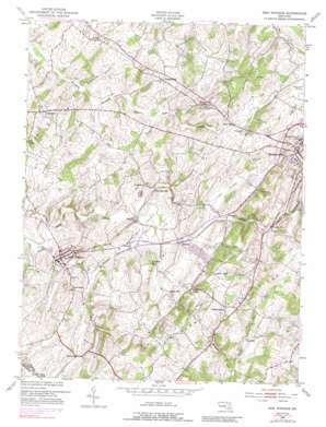
New Windsor Topo Map Maryland
To zoom in, hover over the map of New Windsor
USGS Topo Quad 39077e1 - 1:24,000 scale
| Topo Map Name: | New Windsor |
| USGS Topo Quad ID: | 39077e1 |
| Print Size: | ca. 21 1/4" wide x 27" high |
| Southeast Coordinates: | 39.5° N latitude / 77° W longitude |
| Map Center Coordinates: | 39.5625° N latitude / 77.0625° W longitude |
| U.S. State: | MD |
| Filename: | o39077e1.jpg |
| Download Map JPG Image: | New Windsor topo map 1:24,000 scale |
| Map Type: | Topographic |
| Topo Series: | 7.5´ |
| Map Scale: | 1:24,000 |
| Source of Map Images: | United States Geological Survey (USGS) |
| Alternate Map Versions: |
New Windsor MD 1953, updated 1954 Download PDF Buy paper map New Windsor MD 1953, updated 1954 Download PDF Buy paper map New Windsor MD 1953, updated 1965 Download PDF Buy paper map New Windsor MD 1953, updated 1971 Download PDF Buy paper map New Windsor MD 1953, updated 1972 Download PDF Buy paper map New Windsor MD 1953, updated 1989 Download PDF Buy paper map New Windsor MD 2011 Download PDF Buy paper map New Windsor MD 2014 Download PDF Buy paper map New Windsor MD 2016 Download PDF Buy paper map |
1:24,000 Topo Quads surrounding New Windsor
> Back to 39077e1 at 1:100,000 scale
> Back to 39076a1 at 1:250,000 scale
> Back to U.S. Topo Maps home
New Windsor topo map: Gazetteer
New Windsor: Airports
Carroll County Regional Airport elevation 243m 797′Three J Airport elevation 153m 501′
New Windsor: Mines
Hydes Quarry elevation 157m 515′New Windsor: Parks
Bair Stadium elevation 241m 790′Sulphur Springs Park elevation 146m 479′
Uniontown Historic District elevation 200m 656′
Western Maryland College Historic District elevation 259m 849′
New Windsor: Populated Places
Amanda Hills elevation 208m 682′Avondale elevation 179m 587′
Avondale Ridge elevation 187m 613′
Avondale Run elevation 193m 633′
Baile elevation 258m 846′
Bailes Mill elevation 186m 610′
Belle Grove Square elevation 233m 764′
Blue Ridge View elevation 254m 833′
Bowercrest Park elevation 200m 656′
Canterbury elevation 226m 741′
Carroll Lutheran Village elevation 203m 666′
Carrollyn Manor elevation 240m 787′
Catoctin View elevation 225m 738′
Chadwick Court elevation 215m 705′
Chapel Heights elevation 245m 803′
Charloumyr elevation 152m 498′
Clear Ridge elevation 206m 675′
Daisy Ridge elevation 198m 649′
Forest Hills elevation 249m 816′
Fountain Valley elevation 207m 679′
Frizzellburg elevation 208m 682′
Furnace Hills elevation 210m 688′
Hannleigh Heights elevation 222m 728′
Happy Acres elevation 201m 659′
Jasontown elevation 161m 528′
Jessie Anne Estates elevation 164m 538′
Joseph Meadows elevation 167m 547′
Marbeth Hill elevation 237m 777′
Maring Manor elevation 186m 610′
Marston elevation 205m 672′
Medford elevation 170m 557′
Michaels Ridge elevation 267m 875′
Mill Brothers Hills elevation 169m 554′
Mountain View elevation 255m 836′
Myers Acres elevation 200m 656′
Narnia elevation 196m 643′
New Windsor elevation 152m 498′
Omar Acres elevation 203m 666′
Panorama Estates elevation 218m 715′
Parrs Ridge elevation 216m 708′
Pinch Valley Estates elevation 271m 889′
Pleasant Dale elevation 208m 682′
Ridgeview Estates elevation 238m 780′
Rockland Estates elevation 205m 672′
Rolling Ridge elevation 234m 767′
Roop Mill elevation 195m 639′
Shipley elevation 253m 830′
Snowdens Manor elevation 224m 734′
Somerset elevation 245m 803′
Spring Mills elevation 185m 606′
Stevenson Garden Estates elevation 189m 620′
Sunset Vista elevation 187m 613′
The Fairways at Wakefield elevation 183m 600′
The Hermitage elevation 241m 790′
The Meadows elevation 199m 652′
Tri-Woods elevation 209m 685′
Tyrone elevation 176m 577′
Tyrone Acres elevation 172m 564′
Uniontown elevation 200m 656′
View West Acres elevation 251m 823′
Wagners Mill elevation 184m 603′
Wakefield elevation 154m 505′
Wakefield Estates elevation 205m 672′
Wakefield Mill elevation 166m 544′
Wakefield Valley elevation 192m 629′
Walnut Hill elevation 166m 544′
Warfieldsburg elevation 234m 767′
Wedgewood Terrace elevation 234m 767′
Whispering Meadows elevation 228m 748′
Whistling Ridge Estates elevation 184m 603′
New Windsor: Post Offices
New Windsor Post Office elevation 153m 501′Uniontown Post Office elevation 197m 646′
New Windsor: Ridges
Parrs Ridge elevation 238m 780′New Windsor: Springs
New Windsor Spring elevation 184m 603′New Windsor: Streams
Copps Branch elevation 166m 544′Dickenson Run elevation 135m 442′
Five Daughters Run elevation 142m 465′
Little Morgan Run elevation 188m 616′
Rattlesnake Branch elevation 157m 515′
Turkeyfoot Run elevation 156m 511′
New Windsor: Valleys
Wakefield Valley elevation 154m 505′New Windsor digital topo map on disk
Buy this New Windsor topo map showing relief, roads, GPS coordinates and other geographical features, as a high-resolution digital map file on DVD:
Atlantic Coast (NY, NJ, PA, DE, MD, VA, NC)
Buy digital topo maps: Atlantic Coast (NY, NJ, PA, DE, MD, VA, NC)


