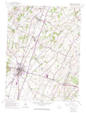
Greencastle Topo Map Pennsylvania
To zoom in, hover over the map of Greencastle
USGS Topo Quad 39077g6 - 1:24,000 scale
| Topo Map Name: | Greencastle |
| USGS Topo Quad ID: | 39077g6 |
| Print Size: | ca. 21 1/4" wide x 27" high |
| Southeast Coordinates: | 39.75° N latitude / 77.625° W longitude |
| Map Center Coordinates: | 39.8125° N latitude / 77.6875° W longitude |
| U.S. State: | PA |
| Filename: | o39077g6.jpg |
| Download Map JPG Image: | Greencastle topo map 1:24,000 scale |
| Map Type: | Topographic |
| Topo Series: | 7.5´ |
| Map Scale: | 1:24,000 |
| Source of Map Images: | United States Geological Survey (USGS) |
| Alternate Map Versions: |
Greencastle PA 1944, updated 1961 Download PDF Buy paper map Greencastle PA 1944, updated 1968 Download PDF Buy paper map Greencastle PA 1944, updated 1974 Download PDF Buy paper map Greencastle PA 1990, updated 1995 Download PDF Buy paper map Greencastle PA 2010 Download PDF Buy paper map Greencastle PA 2013 Download PDF Buy paper map Greencastle PA 2016 Download PDF Buy paper map |
1:24,000 Topo Quads surrounding Greencastle
> Back to 39077e1 at 1:100,000 scale
> Back to 39076a1 at 1:250,000 scale
> Back to U.S. Topo Maps home
Greencastle topo map: Gazetteer
Greencastle: Airports
Cumberland Valley Airstrip elevation 166m 544′Greencastle: Populated Places
Brown Mills elevation 187m 613′Cashtown elevation 197m 646′
Clay Hill elevation 218m 715′
Greencastle elevation 178m 583′
Housum elevation 203m 666′
Kauffman elevation 186m 610′
Marion elevation 193m 633′
Milnor elevation 169m 554′
Polktown elevation 220m 721′
Shady Grove elevation 243m 797′
Waynecastle elevation 214m 702′
Zentmyer elevation 264m 866′
Zullinger elevation 227m 744′
Greencastle: Reservoirs
Greencastle Reservoir elevation 221m 725′Greencastle: Springs
Cold Springs elevation 212m 695′Moss Spring elevation 189m 620′
Muddy Run Spring elevation 213m 698′
Oak Spring elevation 207m 679′
Tayamentasachta Spring elevation 194m 636′
Greencastle digital topo map on disk
Buy this Greencastle topo map showing relief, roads, GPS coordinates and other geographical features, as a high-resolution digital map file on DVD:
Atlantic Coast (NY, NJ, PA, DE, MD, VA, NC)
Buy digital topo maps: Atlantic Coast (NY, NJ, PA, DE, MD, VA, NC)


