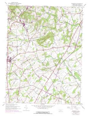
Biglerville Topo Map Pennsylvania
To zoom in, hover over the map of Biglerville
USGS Topo Quad 39077h2 - 1:24,000 scale
| Topo Map Name: | Biglerville |
| USGS Topo Quad ID: | 39077h2 |
| Print Size: | ca. 21 1/4" wide x 27" high |
| Southeast Coordinates: | 39.875° N latitude / 77.125° W longitude |
| Map Center Coordinates: | 39.9375° N latitude / 77.1875° W longitude |
| U.S. State: | PA |
| Filename: | o39077h2.jpg |
| Download Map JPG Image: | Biglerville topo map 1:24,000 scale |
| Map Type: | Topographic |
| Topo Series: | 7.5´ |
| Map Scale: | 1:24,000 |
| Source of Map Images: | United States Geological Survey (USGS) |
| Alternate Map Versions: |
Biglerville PA 1944, updated 1960 Download PDF Buy paper map Biglerville PA 1944, updated 1969 Download PDF Buy paper map Biglerville PA 1944, updated 1974 Download PDF Buy paper map Biglerville PA 1944, updated 1990 Download PDF Buy paper map Biglerville PA 1990, updated 1995 Download PDF Buy paper map Biglerville PA 2010 Download PDF Buy paper map Biglerville PA 2013 Download PDF Buy paper map Biglerville PA 2016 Download PDF Buy paper map |
1:24,000 Topo Quads surrounding Biglerville
> Back to 39077e1 at 1:100,000 scale
> Back to 39076a1 at 1:250,000 scale
> Back to U.S. Topo Maps home
Biglerville topo map: Gazetteer
Biglerville: Airports
Shimerfield Airport elevation 164m 538′Biglerville: Parks
State Game Lands Number 249 elevation 171m 561′Biglerville: Populated Places
Ariosa elevation 247m 810′Aspers elevation 215m 705′
Bendersville elevation 226m 741′
Biglerville elevation 197m 646′
Center Mills elevation 174m 570′
Floradale elevation 195m 639′
Goldenville elevation 187m 613′
Guernsey elevation 195m 639′
Heidlersburg elevation 174m 570′
Hunterstown elevation 169m 554′
Plainview elevation 170m 557′
Shrivers Corners elevation 167m 547′
Table Rock elevation 172m 564′
Biglerville: Streams
Opossum Creek elevation 162m 531′Quaker Run elevation 175m 574′
Biglerville: Summits
Chestnut Hill elevation 290m 951′Rampike Hill elevation 283m 928′
Stone Jug Hill elevation 216m 708′
Wolfpit Hill elevation 295m 967′
Biglerville: Valleys
Cranberry Valley elevation 189m 620′Quaker Valley elevation 188m 616′
Biglerville digital topo map on disk
Buy this Biglerville topo map showing relief, roads, GPS coordinates and other geographical features, as a high-resolution digital map file on DVD:
Atlantic Coast (NY, NJ, PA, DE, MD, VA, NC)
Buy digital topo maps: Atlantic Coast (NY, NJ, PA, DE, MD, VA, NC)


