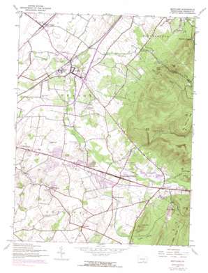
Scotland Topo Map Pennsylvania
To zoom in, hover over the map of Scotland
USGS Topo Quad 39077h5 - 1:24,000 scale
| Topo Map Name: | Scotland |
| USGS Topo Quad ID: | 39077h5 |
| Print Size: | ca. 21 1/4" wide x 27" high |
| Southeast Coordinates: | 39.875° N latitude / 77.5° W longitude |
| Map Center Coordinates: | 39.9375° N latitude / 77.5625° W longitude |
| U.S. State: | PA |
| Filename: | o39077h5.jpg |
| Download Map JPG Image: | Scotland topo map 1:24,000 scale |
| Map Type: | Topographic |
| Topo Series: | 7.5´ |
| Map Scale: | 1:24,000 |
| Source of Map Images: | United States Geological Survey (USGS) |
| Alternate Map Versions: |
Scotland PA 1944, updated 1960 Download PDF Buy paper map Scotland PA 1944, updated 1969 Download PDF Buy paper map Scotland PA 1944, updated 1974 Download PDF Buy paper map Scotland PA 1944, updated 1991 Download PDF Buy paper map Scotland PA 1990, updated 1995 Download PDF Buy paper map Scotland PA 2010 Download PDF Buy paper map Scotland PA 2013 Download PDF Buy paper map Scotland PA 2016 Download PDF Buy paper map |
1:24,000 Topo Quads surrounding Scotland
> Back to 39077e1 at 1:100,000 scale
> Back to 39076a1 at 1:250,000 scale
> Back to U.S. Topo Maps home
Scotland topo map: Gazetteer
Scotland: Airports
Five Lakes Airport elevation 244m 800′Lost Acres Airport elevation 218m 715′
Rocktop Airport elevation 232m 761′
Scotland: Gaps
Locust Gap elevation 299m 980′Scotland: Islands
Conococheague Island elevation 223m 731′Scotland: Populated Places
Aqua elevation 204m 669′Brownsville elevation 292m 958′
Cold Spring elevation 265m 869′
Duffield elevation 246m 807′
East Fayetteville elevation 236m 774′
Falling Spring elevation 214m 702′
Fayetteville elevation 249m 816′
Germantown elevation 253m 830′
Green Village elevation 207m 679′
Greenwood elevation 268m 879′
Guilford Hills elevation 231m 757′
Mount Union elevation 277m 908′
Scotland elevation 213m 698′
Smoketown elevation 234m 767′
West Fayetteville elevation 235m 770′
Woodstock elevation 220m 721′
Scotland: Reservoirs
Shippensburg Reservoir elevation 313m 1026′Scotland: Springs
Crawford Springs elevation 358m 1174′Falling Spring elevation 220m 721′
Scotland: Streams
Cold Spring Run elevation 230m 754′Mountain Run elevation 205m 672′
Phillaman Run elevation 207m 679′
Shirley Run elevation 265m 869′
Stump Run elevation 258m 846′
Scotland: Summits
Eagle Rock elevation 468m 1535′Kettle Springs Mountain elevation 483m 1584′
Little Mountain elevation 364m 1194′
Mount Cydonia elevation 386m 1266′
Pleasant Peak elevation 565m 1853′
Poke Hill elevation 494m 1620′
Stony Knob elevation 376m 1233′
Scotland: Valleys
Devil Alex Hollow elevation 276m 905′English Valley elevation 251m 823′
Griers Hollow elevation 316m 1036′
Scotland digital topo map on disk
Buy this Scotland topo map showing relief, roads, GPS coordinates and other geographical features, as a high-resolution digital map file on DVD:
Atlantic Coast (NY, NJ, PA, DE, MD, VA, NC)
Buy digital topo maps: Atlantic Coast (NY, NJ, PA, DE, MD, VA, NC)


