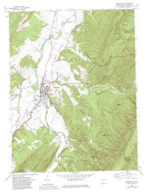
Moorefield Topo Map West Virginia
To zoom in, hover over the map of Moorefield
USGS Topo Quad 39078a8 - 1:24,000 scale
| Topo Map Name: | Moorefield |
| USGS Topo Quad ID: | 39078a8 |
| Print Size: | ca. 21 1/4" wide x 27" high |
| Southeast Coordinates: | 39° N latitude / 78.875° W longitude |
| Map Center Coordinates: | 39.0625° N latitude / 78.9375° W longitude |
| U.S. State: | WV |
| Filename: | o39078a8.jpg |
| Download Map JPG Image: | Moorefield topo map 1:24,000 scale |
| Map Type: | Topographic |
| Topo Series: | 7.5´ |
| Map Scale: | 1:24,000 |
| Source of Map Images: | United States Geological Survey (USGS) |
| Alternate Map Versions: |
Moorefield WV 1970, updated 1974 Download PDF Buy paper map Moorefield WV 1970, updated 1982 Download PDF Buy paper map Moorefield WV 2011 Download PDF Buy paper map Moorefield WV 2014 Download PDF Buy paper map Moorefield WV 2016 Download PDF Buy paper map |
1:24,000 Topo Quads surrounding Moorefield
> Back to 39078a1 at 1:100,000 scale
> Back to 39078a1 at 1:250,000 scale
> Back to U.S. Topo Maps home
Moorefield topo map: Gazetteer
Moorefield: Parks
Moorefield Historic District elevation 249m 816′Moorefield: Populated Places
Cunningham elevation 247m 810′Fort Run elevation 298m 977′
Mapleton (historical) elevation 233m 764′
Meadow elevation 242m 793′
Moorefield elevation 247m 810′
Tannery elevation 272m 892′
Taylor elevation 260m 853′
Moorefield: Ridges
Potato Row elevation 607m 1991′Timber Ridge elevation 450m 1476′
Moorefield: Springs
Harry Veeders Spring elevation 344m 1128′Moorefield: Streams
Dumpling Run elevation 238m 780′Fort Run elevation 236m 774′
Hutton Run elevation 246m 807′
Sawmill Run elevation 301m 987′
South Fork South Branch Potomac River elevation 241m 790′
Stony Run elevation 263m 862′
Moorefield: Summits
Coburn Knob elevation 609m 1998′Phils Knob elevation 752m 2467′
Powder Spring Knob elevation 625m 2050′
Sugarloaf Knob elevation 647m 2122′
Three Square Knob elevation 573m 1879′
Moorefield: Valleys
Dover Hollow elevation 309m 1013′Jemima Hollow elevation 436m 1430′
Sugarcamp Hollow elevation 280m 918′
Sulphur Spring Hollow elevation 265m 869′
Tom Williams Hollow elevation 356m 1167′
Williams Hollow elevation 251m 823′
Wood Hollow elevation 323m 1059′
Moorefield digital topo map on disk
Buy this Moorefield topo map showing relief, roads, GPS coordinates and other geographical features, as a high-resolution digital map file on DVD:


