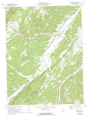
Burlington Topo Map West Virginia
To zoom in, hover over the map of Burlington
USGS Topo Quad 39078c8 - 1:24,000 scale
| Topo Map Name: | Burlington |
| USGS Topo Quad ID: | 39078c8 |
| Print Size: | ca. 21 1/4" wide x 27" high |
| Southeast Coordinates: | 39.25° N latitude / 78.875° W longitude |
| Map Center Coordinates: | 39.3125° N latitude / 78.9375° W longitude |
| U.S. State: | WV |
| Filename: | o39078c8.jpg |
| Download Map JPG Image: | Burlington topo map 1:24,000 scale |
| Map Type: | Topographic |
| Topo Series: | 7.5´ |
| Map Scale: | 1:24,000 |
| Source of Map Images: | United States Geological Survey (USGS) |
| Alternate Map Versions: |
Burlington WV 1972, updated 1975 Download PDF Buy paper map Burlington WV 1972, updated 1975 Download PDF Buy paper map Burlington WV 2011 Download PDF Buy paper map Burlington WV 2014 Download PDF Buy paper map Burlington WV 2016 Download PDF Buy paper map |
1:24,000 Topo Quads surrounding Burlington
> Back to 39078a1 at 1:100,000 scale
> Back to 39078a1 at 1:250,000 scale
> Back to U.S. Topo Maps home
Burlington topo map: Gazetteer
Burlington: Dams
Patterson Creek Structure 15 Dam elevation 287m 941′Patterson Creek Structure 20 Dam elevation 293m 961′
Patterson Creek Structure 22 Dam elevation 265m 869′
Patterson Creek Structure 24 Dam elevation 252m 826′
Patterson Creek Structure 25 Dam elevation 225m 738′
Patterson Creek Structure 26 Dam elevation 214m 702′
Patterson Creek Structure 47 Dam elevation 242m 793′
Patterson Creek Structure 48 Dam elevation 250m 820′
Patterson Creek Structure 52 Dam elevation 254m 833′
Burlington: Populated Places
Burlington elevation 226m 741′Markwood elevation 261m 856′
Rada elevation 263m 862′
Ridgeville elevation 314m 1030′
Russelldale elevation 268m 879′
Burlington: Springs
Anderson Farm Spring elevation 280m 918′Bane Brothers Spring elevation 244m 800′
Cave Gap Spring elevation 489m 1604′
Hampshire County Spring elevation 332m 1089′
High Farm Spring elevation 324m 1062′
Leatherman Farm Spring elevation 395m 1295′
Manorland Post Motel Spring elevation 278m 912′
Burlington: Streams
Buskirk Run elevation 252m 826′Camp Run elevation 249m 816′
Cave Run elevation 242m 793′
Clints Run elevation 249m 816′
Dry Run elevation 234m 767′
Dry Run elevation 248m 813′
Elliber Run elevation 233m 764′
Elmlick Run elevation 271m 889′
Harness Run elevation 254m 833′
Johnson Run elevation 214m 702′
Liller Run elevation 270m 885′
Mikes Run elevation 241m 790′
Mill Creek elevation 222m 728′
Mud Run elevation 229m 751′
Mud Run elevation 213m 698′
Parrill Run elevation 269m 882′
Pursley Run elevation 247m 810′
Sugar Run elevation 230m 754′
Whipps Run elevation 211m 692′
Wild Meadow Run elevation 230m 754′
Burlington digital topo map on disk
Buy this Burlington topo map showing relief, roads, GPS coordinates and other geographical features, as a high-resolution digital map file on DVD:


