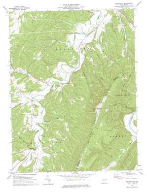
Headsville Topo Map West Virginia
To zoom in, hover over the map of Headsville
USGS Topo Quad 39078d7 - 1:24,000 scale
| Topo Map Name: | Headsville |
| USGS Topo Quad ID: | 39078d7 |
| Print Size: | ca. 21 1/4" wide x 27" high |
| Southeast Coordinates: | 39.375° N latitude / 78.75° W longitude |
| Map Center Coordinates: | 39.4375° N latitude / 78.8125° W longitude |
| U.S. State: | WV |
| Filename: | o39078d7.jpg |
| Download Map JPG Image: | Headsville topo map 1:24,000 scale |
| Map Type: | Topographic |
| Topo Series: | 7.5´ |
| Map Scale: | 1:24,000 |
| Source of Map Images: | United States Geological Survey (USGS) |
| Alternate Map Versions: |
Headsville WV 1973, updated 1975 Download PDF Buy paper map Headsville WV 2011 Download PDF Buy paper map Headsville WV 2014 Download PDF Buy paper map Headsville WV 2016 Download PDF Buy paper map |
1:24,000 Topo Quads surrounding Headsville
> Back to 39078a1 at 1:100,000 scale
> Back to 39078a1 at 1:250,000 scale
> Back to U.S. Topo Maps home
Headsville topo map: Gazetteer
Headsville: Dams
Patterson Creek Structure 36 Dam elevation 219m 718′Patterson Creek Structure 37 Dam elevation 220m 721′
Patterson Creek Structure 38 Dam elevation 252m 826′
Patterson Creek Structure 44 Dam elevation 197m 646′
Patterson Creek Structure 45 Dam elevation 194m 636′
Patterson Creek Structure 46 Dam elevation 220m 721′
Headsville: Populated Places
Champwood elevation 194m 636′Headsville elevation 208m 682′
Reeses Mill elevation 202m 662′
Headsville: Springs
Fox Farm Spring elevation 270m 885′Headsville: Streams
Allen Run elevation 232m 761′Beaver Run elevation 204m 669′
Broad Run elevation 188m 616′
Cabin Run elevation 197m 646′
Dowden Run elevation 202m 662′
Graveyard Run elevation 183m 600′
Hazel Run elevation 190m 623′
Hollenbeck Run elevation 199m 652′
Horseshoe Run elevation 181m 593′
Kellar Run elevation 182m 597′
Long Run elevation 226m 741′
Mikes Run elevation 207m 679′
Mill Run elevation 182m 597′
Ochre Run elevation 209m 685′
Pargut Run elevation 220m 721′
Rinehart Run elevation 184m 603′
Spring Run elevation 208m 682′
Staggs Run elevation 204m 669′
Sugarcamp Run elevation 184m 603′
Sycamore Run elevation 204m 669′
Headsville: Summits
Horseshoe Mountain elevation 359m 1177′Slate Lick Knob elevation 511m 1676′
Headsville digital topo map on disk
Buy this Headsville topo map showing relief, roads, GPS coordinates and other geographical features, as a high-resolution digital map file on DVD:


