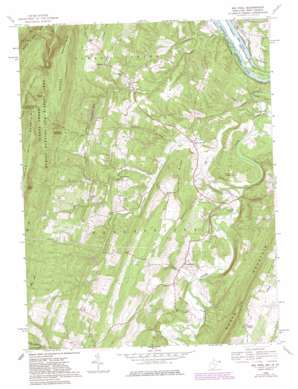
Big Pool Topo Map West Virginia
To zoom in, hover over the map of Big Pool
USGS Topo Quad 39078e1 - 1:24,000 scale
| Topo Map Name: | Big Pool |
| USGS Topo Quad ID: | 39078e1 |
| Print Size: | ca. 21 1/4" wide x 27" high |
| Southeast Coordinates: | 39.5° N latitude / 78° W longitude |
| Map Center Coordinates: | 39.5625° N latitude / 78.0625° W longitude |
| U.S. States: | WV, MD |
| Filename: | o39078e1.jpg |
| Download Map JPG Image: | Big Pool topo map 1:24,000 scale |
| Map Type: | Topographic |
| Topo Series: | 7.5´ |
| Map Scale: | 1:24,000 |
| Source of Map Images: | United States Geological Survey (USGS) |
| Alternate Map Versions: |
Big Pool MD 1958, updated 1959 Download PDF Buy paper map Big Pool MD 1958, updated 1968 Download PDF Buy paper map Big Pool MD 1958, updated 1977 Download PDF Buy paper map Big Pool MD 1958, updated 1982 Download PDF Buy paper map Big Pool MD 1998, updated 1999 Download PDF Buy paper map Big Pool MD 2011 Download PDF Buy paper map Big Pool MD 2014 Download PDF Buy paper map Big Pool MD 2016 Download PDF Buy paper map |
1:24,000 Topo Quads surrounding Big Pool
> Back to 39078e1 at 1:100,000 scale
> Back to 39078a1 at 1:250,000 scale
> Back to U.S. Topo Maps home
Big Pool topo map: Gazetteer
Big Pool: Bridges
Parks Gap Bridge elevation 127m 416′Big Pool: Crossings
Runners Ferry (historical) elevation 112m 367′Big Pool: Dams
Sleepy Hollow Lake Dam elevation 219m 718′Big Pool: Gaps
Parks Gap elevation 330m 1082′Big Pool: Lakes
Big Pool elevation 118m 387′Big Pool: Parks
Fort Frederick State Park elevation 145m 475′Big Pool: Populated Places
Baxter elevation 185m 606′Big Pool elevation 130m 426′
Elk Branch (historical) elevation 207m 679′
Holton elevation 175m 574′
Johnsontown elevation 135m 442′
Snyders elevation 198m 649′
Tomahawk elevation 143m 469′
Big Pool: Post Offices
Big Pool Post Office elevation 130m 426′Big Pool: Ridges
Devils Nose elevation 265m 869′Ferrell Ridge elevation 227m 744′
Big Pool: Springs
Boyd Rooney Farm Spring elevation 186m 610′Johnsontown Spring elevation 162m 531′
Tomahawk Spring elevation 205m 672′
Big Pool: Streams
Cherry Run elevation 112m 367′Gough Run elevation 117m 383′
Higgins Run elevation 135m 442′
Tilhance Creek elevation 115m 377′
Tomahawk Run elevation 127m 416′
Whites Run elevation 141m 462′
Big Pool: Summits
Cannon Hill elevation 212m 695′Hedges Mountain elevation 379m 1243′
Paines Knob elevation 415m 1361′
Short Mountain elevation 423m 1387′
Whites Knob elevation 467m 1532′
Big Pool digital topo map on disk
Buy this Big Pool topo map showing relief, roads, GPS coordinates and other geographical features, as a high-resolution digital map file on DVD:


