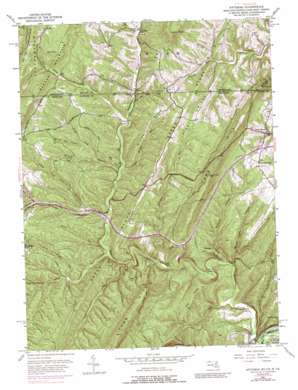
Artemas Topo Map Maryland
To zoom in, hover over the map of Artemas
USGS Topo Quad 39078f4 - 1:24,000 scale
| Topo Map Name: | Artemas |
| USGS Topo Quad ID: | 39078f4 |
| Print Size: | ca. 21 1/4" wide x 27" high |
| Southeast Coordinates: | 39.625° N latitude / 78.375° W longitude |
| Map Center Coordinates: | 39.6875° N latitude / 78.4375° W longitude |
| U.S. States: | MD, WV, PA |
| Filename: | o39078f4.jpg |
| Download Map JPG Image: | Artemas topo map 1:24,000 scale |
| Map Type: | Topographic |
| Topo Series: | 7.5´ |
| Map Scale: | 1:24,000 |
| Source of Map Images: | United States Geological Survey (USGS) |
| Alternate Map Versions: |
Artemas PA 1950, updated 1960 Download PDF Buy paper map Artemas PA 1950, updated 1967 Download PDF Buy paper map Artemas PA 1950, updated 1975 Download PDF Buy paper map Artemas PA 1950, updated 1989 Download PDF Buy paper map Artemas PA 1950, updated 1997 Download PDF Buy paper map Artemas PA 1950, updated 1997 Download PDF Buy paper map Artemas PA 1951 Download PDF Buy paper map Artemas PA 1951 Download PDF Buy paper map Artemas PA 2011 Download PDF Buy paper map Artemas PA 2013 Download PDF Buy paper map Artemas PA 2016 Download PDF Buy paper map |
1:24,000 Topo Quads surrounding Artemas
> Back to 39078e1 at 1:100,000 scale
> Back to 39078a1 at 1:250,000 scale
> Back to U.S. Topo Maps home
Artemas topo map: Gazetteer
Artemas: Parks
Billmeyer Game Refuge elevation 295m 967′Artemas: Populated Places
Artemas elevation 298m 977′Little Orleans elevation 150m 492′
Piney Grove elevation 289m 948′
Artemas: Post Offices
Little Orleans Post Office elevation 151m 495′Artemas: Ranges
Town Hill elevation 467m 1532′Town Hill elevation 467m 1532′
Artemas: Reservoirs
Long Pond elevation 169m 554′Artemas: Ridges
Big Ridge elevation 328m 1076′Divide Ridge elevation 334m 1095′
Green Ridge elevation 384m 1259′
Green Ridge elevation 396m 1299′
Keenan Ridge elevation 246m 807′
Piney Ridge elevation 363m 1190′
Piney Ridge elevation 343m 1125′
Artemas: Springs
Black Sulphur Spring elevation 274m 898′White Sulphur Spring elevation 243m 797′
Artemas: Streams
Bear Camp Branch elevation 247m 810′Bear Camp Branch elevation 247m 810′
Big Divide Run elevation 229m 751′
Black Sulphur Run elevation 229m 751′
Deep Run elevation 200m 656′
Flat Run elevation 148m 485′
Line Run elevation 256m 839′
Line Run elevation 253m 830′
Piclic Run elevation 211m 692′
Terrapin Run elevation 182m 597′
White Sulphur Run elevation 212m 695′
Artemas: Summits
Gabriel Knob elevation 528m 1732′Ragged Mountain elevation 522m 1712′
Artemas: Trails
Hines Trail elevation 362m 1187′Hinkle Trail elevation 360m 1181′
Imes Trail elevation 350m 1148′
Jim Trail elevation 374m 1227′
Artemas: Valleys
Cow Hollow elevation 248m 813′Kifer Hollow elevation 260m 853′
Little Pine Lick Hollow elevation 225m 738′
Mudlick Hollow elevation 194m 636′
Pine Lick Hollow elevation 228m 748′
Pratt Hollow elevation 218m 715′
Spring Lick Hollow elevation 161m 528′
White Oak Hollow elevation 263m 862′
Artemas digital topo map on disk
Buy this Artemas topo map showing relief, roads, GPS coordinates and other geographical features, as a high-resolution digital map file on DVD:


