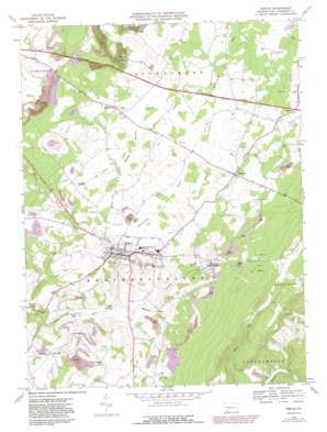
Berlin Topo Map Pennsylvania
To zoom in, hover over the map of Berlin
USGS Topo Quad 39078h8 - 1:24,000 scale
| Topo Map Name: | Berlin |
| USGS Topo Quad ID: | 39078h8 |
| Print Size: | ca. 21 1/4" wide x 27" high |
| Southeast Coordinates: | 39.875° N latitude / 78.875° W longitude |
| Map Center Coordinates: | 39.9375° N latitude / 78.9375° W longitude |
| U.S. State: | PA |
| Filename: | o39078h8.jpg |
| Download Map JPG Image: | Berlin topo map 1:24,000 scale |
| Map Type: | Topographic |
| Topo Series: | 7.5´ |
| Map Scale: | 1:24,000 |
| Source of Map Images: | United States Geological Survey (USGS) |
| Alternate Map Versions: |
Berlin PA 1967, updated 1970 Download PDF Buy paper map Berlin PA 1967, updated 1973 Download PDF Buy paper map Berlin PA 1967, updated 1982 Download PDF Buy paper map Berlin PA 1967, updated 1991 Download PDF Buy paper map Berlin PA 1967, updated 1991 Download PDF Buy paper map Berlin PA 1977, updated 1978 Download PDF Buy paper map Berlin PA 2010 Download PDF Buy paper map Berlin PA 2013 Download PDF Buy paper map Berlin PA 2016 Download PDF Buy paper map |
1:24,000 Topo Quads surrounding Berlin
> Back to 39078e1 at 1:100,000 scale
> Back to 39078a1 at 1:250,000 scale
> Back to U.S. Topo Maps home
Berlin topo map: Gazetteer
Berlin: Airports
North View Airport elevation 696m 2283′Berlin: Mines
Shipley Brothers Mine elevation 723m 2372′Berlin: Populated Places
Berlin elevation 710m 2329′Brotherton elevation 708m 2322′
Downey elevation 714m 2342′
East End elevation 709m 2326′
Goodtown elevation 659m 2162′
Macdonaldton elevation 663m 2175′
Mineral Spring elevation 616m 2020′
Niver Junction elevation 626m 2053′
Pine Hill elevation 727m 2385′
Roxbury elevation 688m 2257′
Salco elevation 634m 2080′
Shaft elevation 640m 2099′
Berlin: Post Offices
Pine Hill Post Office (historical) elevation 727m 2385′Stony Creek Post Office (historical) elevation 688m 2257′
Berlin: Streams
Glades Creek elevation 674m 2211′Hays Run elevation 632m 2073′
Reitz Creek elevation 681m 2234′
Berlin: Valleys
Sandy Hollow elevation 678m 2224′Berlin digital topo map on disk
Buy this Berlin topo map showing relief, roads, GPS coordinates and other geographical features, as a high-resolution digital map file on DVD:


