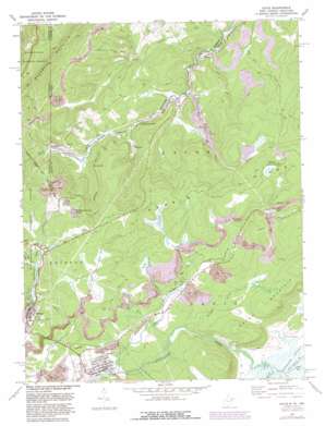
Davis Topo Map West Virginia
To zoom in, hover over the map of Davis
USGS Topo Quad 39079b4 - 1:24,000 scale
| Topo Map Name: | Davis |
| USGS Topo Quad ID: | 39079b4 |
| Print Size: | ca. 21 1/4" wide x 27" high |
| Southeast Coordinates: | 39.125° N latitude / 79.375° W longitude |
| Map Center Coordinates: | 39.1875° N latitude / 79.4375° W longitude |
| U.S. States: | WV, MD |
| Filename: | o39079b4.jpg |
| Download Map JPG Image: | Davis topo map 1:24,000 scale |
| Map Type: | Topographic |
| Topo Series: | 7.5´ |
| Map Scale: | 1:24,000 |
| Source of Map Images: | United States Geological Survey (USGS) |
| Alternate Map Versions: |
Kempton WV 1949 Download PDF Buy paper map Kempton WV 1949, updated 1949 Download PDF Buy paper map Davis WV 1967, updated 1972 Download PDF Buy paper map Davis WV 1967, updated 1972 Download PDF Buy paper map Davis WV 1967, updated 1975 Download PDF Buy paper map Davis WV 1967, updated 1982 Download PDF Buy paper map Davis WV 1967, updated 1982 Download PDF Buy paper map Davis WV 1995, updated 1998 Download PDF Buy paper map Davis WV 2011 Download PDF Buy paper map Davis WV 2014 Download PDF Buy paper map Davis WV 2016 Download PDF Buy paper map |
| FStopo: | US Forest Service topo Davis is available: Download FStopo PDF Download FStopo TIF |
1:24,000 Topo Quads surrounding Davis
> Back to 39079a1 at 1:100,000 scale
> Back to 39078a1 at 1:250,000 scale
> Back to U.S. Topo Maps home
Davis topo map: Gazetteer
Davis: Dams
City of Thomas Dam elevation 919m 3015′City of Thomas Reservoir Dam elevation 940m 3083′
Elk Run Water Supply Dam elevation 966m 3169′
Davis: Parks
Fairfax Stone Historical Monument elevation 962m 3156′Fairfax Stone State Park elevation 963m 3159′
Davis: Populated Places
Davis elevation 945m 3100′Dobbin elevation 792m 2598′
Fairfax elevation 931m 3054′
Gatzmer elevation 992m 3254′
Henry elevation 821m 2693′
Kempton elevation 832m 2729′
Kempton Junction elevation 821m 2693′
Thomas elevation 925m 3034′
William elevation 910m 2985′
Wilsonia (historical) elevation 836m 2742′
Davis: Post Offices
Davis Post Office elevation 945m 3100′Thomas Post Office elevation 925m 3034′
Davis: Reservoirs
Elk Run Reservoir elevation 966m 3169′Davis: Springs
Kempton Spring elevation 883m 2896′Davis: Streams
Beaver Creek elevation 936m 3070′Chaffey Run elevation 941m 3087′
Chestnut Ridge Run elevation 792m 2598′
Chestnut Ridge Run elevation 793m 2601′
Clower Run elevation 951m 3120′
Deakin Run elevation 806m 2644′
Devils Run elevation 939m 3080′
Elk Run elevation 804m 2637′
Glade Run elevation 907m 2975′
Glade Run elevation 957m 3139′
Hawkins Run elevation 944m 3097′
Laurel Run elevation 766m 2513′
Little Blackwater River elevation 957m 3139′
Lost Run elevation 947m 3106′
Red Oak Run elevation 793m 2601′
Red Oak Run elevation 793m 2601′
Sand Run elevation 903m 2962′
South Branch Wolf Run elevation 748m 2454′
Yellow Creek elevation 956m 3136′
Davis: Summits
Hoye-Crest elevation 1027m 3369′Roger Camp Hill elevation 979m 3211′
Davis: Valleys
Canaan Valley elevation 957m 3139′Davis digital topo map on disk
Buy this Davis topo map showing relief, roads, GPS coordinates and other geographical features, as a high-resolution digital map file on DVD:


