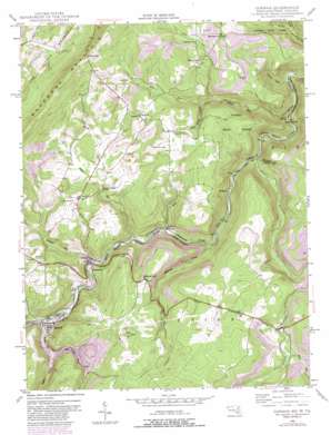
Gorman Topo Map Maryland
To zoom in, hover over the map of Gorman
USGS Topo Quad 39079c3 - 1:24,000 scale
| Topo Map Name: | Gorman |
| USGS Topo Quad ID: | 39079c3 |
| Print Size: | ca. 21 1/4" wide x 27" high |
| Southeast Coordinates: | 39.25° N latitude / 79.25° W longitude |
| Map Center Coordinates: | 39.3125° N latitude / 79.3125° W longitude |
| U.S. States: | MD, WV |
| Filename: | o39079c3.jpg |
| Download Map JPG Image: | Gorman topo map 1:24,000 scale |
| Map Type: | Topographic |
| Topo Series: | 7.5´ |
| Map Scale: | 1:24,000 |
| Source of Map Images: | United States Geological Survey (USGS) |
| Alternate Map Versions: |
Gorman MD 1949, updated 1965 Download PDF Buy paper map Gorman MD 1949, updated 1970 Download PDF Buy paper map Gorman MD 1949, updated 1976 Download PDF Buy paper map Gorman MD 1949, updated 1982 Download PDF Buy paper map Gorman MD 1950 Download PDF Buy paper map Gorman MD 1950, updated 1950 Download PDF Buy paper map Gorman MD 2011 Download PDF Buy paper map Gorman MD 2014 Download PDF Buy paper map Gorman MD 2016 Download PDF Buy paper map |
1:24,000 Topo Quads surrounding Gorman
> Back to 39079a1 at 1:100,000 scale
> Back to 39078a1 at 1:250,000 scale
> Back to U.S. Topo Maps home
Gorman topo map: Gazetteer
Gorman: Bridges
Gormania Bridge elevation 704m 2309′Gorman: Dams
Little Buffalo Creek - North Branch Dam elevation 790m 2591′Gorman: Forests
Potomac State Forest elevation 805m 2641′Gorman: Gaps
Kelso Gap elevation 906m 2972′Gorman: Populated Places
Bayard elevation 714m 2342′Berrett (historical) elevation 709m 2326′
Bradshaw (historical) elevation 650m 2132′
Fort Pendleton elevation 798m 2618′
Gorman elevation 711m 2332′
Gormania elevation 711m 2332′
Kearney elevation 823m 2700′
Schell elevation 615m 2017′
Steyer elevation 710m 2329′
Wallman elevation 664m 2178′
Gorman: Post Offices
Gormania Post Office elevation 710m 2329′Gorman: Springs
Dales Spring elevation 800m 2624′Gorman: Streams
Buffalo Creek elevation 711m 2332′Crooked Run elevation 588m 1929′
Difficult Creek elevation 687m 2253′
Glade Run elevation 704m 2309′
Laurel Run elevation 603m 1978′
Little Buffalo Creek elevation 740m 2427′
Mill Run elevation 787m 2582′
North Prong Lostland Run elevation 652m 2139′
Nydegger Run elevation 703m 2306′
Rileys Spring Branch elevation 735m 2411′
South Prong Lostland Run elevation 652m 2139′
Steyer Run elevation 701m 2299′
Stony River elevation 639m 2096′
Trout Run elevation 721m 2365′
Gorman: Summits
Difficult Hill elevation 881m 2890′Gorman digital topo map on disk
Buy this Gorman topo map showing relief, roads, GPS coordinates and other geographical features, as a high-resolution digital map file on DVD:


