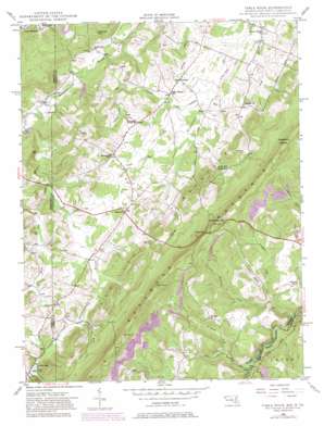
Table Rock Topo Map Maryland
To zoom in, hover over the map of Table Rock
USGS Topo Quad 39079c4 - 1:24,000 scale
| Topo Map Name: | Table Rock |
| USGS Topo Quad ID: | 39079c4 |
| Print Size: | ca. 21 1/4" wide x 27" high |
| Southeast Coordinates: | 39.25° N latitude / 79.375° W longitude |
| Map Center Coordinates: | 39.3125° N latitude / 79.4375° W longitude |
| U.S. States: | MD, WV |
| Filename: | o39079c4.jpg |
| Download Map JPG Image: | Table Rock topo map 1:24,000 scale |
| Map Type: | Topographic |
| Topo Series: | 7.5´ |
| Map Scale: | 1:24,000 |
| Source of Map Images: | United States Geological Survey (USGS) |
| Alternate Map Versions: |
Table Rock MD 1948, updated 1962 Download PDF Buy paper map Table Rock MD 1948, updated 1968 Download PDF Buy paper map Table Rock MD 1948, updated 1975 Download PDF Buy paper map Table Rock MD 1948, updated 1982 Download PDF Buy paper map Table Rock MD 1948, updated 1998 Download PDF Buy paper map Table Rock MD 1949 Download PDF Buy paper map Table Rock MD 1949 Download PDF Buy paper map Table Rock MD 1997, updated 2001 Download PDF Buy paper map Table Rock MD 1997, updated 2001 Download PDF Buy paper map Table Rock MD 2011 Download PDF Buy paper map Table Rock MD 2014 Download PDF Buy paper map Table Rock MD 2016 Download PDF Buy paper map |
| FStopo: | US Forest Service topo Table Rock is available: Download FStopo PDF Download FStopo TIF |
1:24,000 Topo Quads surrounding Table Rock
> Back to 39079a1 at 1:100,000 scale
> Back to 39078a1 at 1:250,000 scale
> Back to U.S. Topo Maps home
Table Rock topo map: Gazetteer
Table Rock: Airports
Greater Gortner Airport elevation 761m 2496′Table Rock: Flats
Swans Meadow elevation 742m 2434′Table Rock: Populated Places
Gortner elevation 741m 2431′Redhouse elevation 775m 2542′
Silver Lake elevation 765m 2509′
Sunnyside elevation 770m 2526′
Wilson elevation 760m 2493′
Table Rock: Post Offices
Wilson Post Office (historical) elevation 761m 2496′Table Rock: Reservoirs
Silver Lake elevation 762m 2500′Table Rock: Ridges
Moon Ridge elevation 849m 2785′Table Rock: Streams
Ambrose Run elevation 736m 2414′Aronhalt Fork elevation 751m 2463′
Cherry Creek elevation 731m 2398′
Clark Run elevation 741m 2431′
Douglass Run elevation 737m 2417′
Fox Run elevation 748m 2454′
Frozen Camp Run elevation 731m 2398′
Maple Run elevation 738m 2421′
McMillan Fork elevation 746m 2447′
North Fork Sand Run elevation 761m 2496′
Red Oak Creek elevation 758m 2486′
Rhine Creek elevation 735m 2411′
Sand Run elevation 755m 2477′
Sand Spring Run elevation 750m 2460′
Shields Run elevation 723m 2372′
South Fork Sand Run elevation 762m 2500′
Table Rock: Summits
Allegheny Heights elevation 972m 3188′Charcoal Hill elevation 825m 2706′
Conneway Hill elevation 969m 3179′
Roth Rock elevation 979m 3211′
Table Rock: Valleys
Pleasant Valley elevation 752m 2467′Table Rock digital topo map on disk
Buy this Table Rock topo map showing relief, roads, GPS coordinates and other geographical features, as a high-resolution digital map file on DVD:


