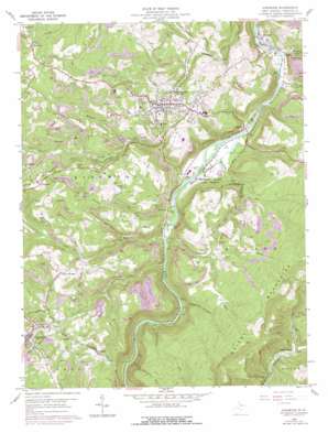
Kingwood Topo Map West Virginia
To zoom in, hover over the map of Kingwood
USGS Topo Quad 39079d6 - 1:24,000 scale
| Topo Map Name: | Kingwood |
| USGS Topo Quad ID: | 39079d6 |
| Print Size: | ca. 21 1/4" wide x 27" high |
| Southeast Coordinates: | 39.375° N latitude / 79.625° W longitude |
| Map Center Coordinates: | 39.4375° N latitude / 79.6875° W longitude |
| U.S. State: | WV |
| Filename: | o39079d6.jpg |
| Download Map JPG Image: | Kingwood topo map 1:24,000 scale |
| Map Type: | Topographic |
| Topo Series: | 7.5´ |
| Map Scale: | 1:24,000 |
| Source of Map Images: | United States Geological Survey (USGS) |
| Alternate Map Versions: |
Kingwood WV 1960, updated 1961 Download PDF Buy paper map Kingwood WV 1960, updated 1966 Download PDF Buy paper map Kingwood WV 1960, updated 1978 Download PDF Buy paper map Kingwood WV 1960, updated 1998 Download PDF Buy paper map Kingwood WV 1997, updated 2002 Download PDF Buy paper map Kingwood WV 2011 Download PDF Buy paper map Kingwood WV 2014 Download PDF Buy paper map Kingwood WV 2016 Download PDF Buy paper map |
1:24,000 Topo Quads surrounding Kingwood
> Back to 39079a1 at 1:100,000 scale
> Back to 39078a1 at 1:250,000 scale
> Back to U.S. Topo Maps home
Kingwood topo map: Gazetteer
Kingwood: Airports
Moore Field elevation 546m 1791′Kingwood: Bends
Dunkard Bottom elevation 380m 1246′Kingwood: Crossings
Fairfax Ferry (historical) elevation 370m 1213′Trowbridge Ferry (historical) elevation 382m 1253′
Kingwood: Parks
Briery Mountain Wildlife Management Area elevation 725m 2378′Camp Dawson Public Hunting Area elevation 583m 1912′
Kingwood: Populated Places
Albright elevation 369m 1210′Amblersburg elevation 489m 1604′
Anderson elevation 574m 1883′
Atlantic (historical) elevation 566m 1856′
Blaser elevation 579m 1899′
Borgman elevation 695m 2280′
Caddell elevation 375m 1230′
Camp Ground elevation 602m 1975′
Heathers Run elevation 400m 1312′
Irona elevation 592m 1942′
Kingwood elevation 553m 1814′
Manown elevation 667m 2188′
Preston elevation 396m 1299′
Saint Joe elevation 371m 1217′
Snider elevation 517m 1696′
Trowbridge (historical) elevation 386m 1266′
Tunnelton elevation 556m 1824′
Whetsell (historical) elevation 430m 1410′
Zevely elevation 486m 1594′
Kingwood: Streams
Ashpole Run elevation 369m 1210′Bearwallow Run elevation 400m 1312′
Buffalo Run elevation 373m 1223′
Church Creek elevation 635m 2083′
Daugherty Run elevation 367m 1204′
Elsey Run elevation 370m 1213′
Heather Run elevation 377m 1236′
Hickory Bearpen Run elevation 415m 1361′
Joes Run elevation 383m 1256′
Lick Run elevation 384m 1259′
Morgan Run elevation 376m 1233′
Pringle Run elevation 384m 1259′
South Fork Greens Run elevation 466m 1528′
Spruce Run elevation 479m 1571′
Stamping Ground Run elevation 392m 1286′
Kingwood digital topo map on disk
Buy this Kingwood topo map showing relief, roads, GPS coordinates and other geographical features, as a high-resolution digital map file on DVD:


