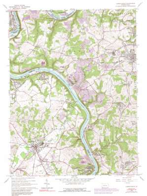
Carmichaels Topo Map Pennsylvania
To zoom in, hover over the map of Carmichaels
USGS Topo Quad 39079h8 - 1:24,000 scale
| Topo Map Name: | Carmichaels |
| USGS Topo Quad ID: | 39079h8 |
| Print Size: | ca. 21 1/4" wide x 27" high |
| Southeast Coordinates: | 39.875° N latitude / 79.875° W longitude |
| Map Center Coordinates: | 39.9375° N latitude / 79.9375° W longitude |
| U.S. State: | PA |
| Filename: | o39079h8.jpg |
| Download Map JPG Image: | Carmichaels topo map 1:24,000 scale |
| Map Type: | Topographic |
| Topo Series: | 7.5´ |
| Map Scale: | 1:24,000 |
| Source of Map Images: | United States Geological Survey (USGS) |
| Alternate Map Versions: |
Carmichaels PA 1964, updated 1965 Download PDF Buy paper map Carmichaels PA 1964, updated 1973 Download PDF Buy paper map Carmichaels PA 1964, updated 1979 Download PDF Buy paper map Carmichaels PA 1964, updated 1991 Download PDF Buy paper map Carmichaels PA 1964, updated 1991 Download PDF Buy paper map Carmichaels PA 2010 Download PDF Buy paper map Carmichaels PA 2013 Download PDF Buy paper map Carmichaels PA 2016 Download PDF Buy paper map |
1:24,000 Topo Quads surrounding Carmichaels
> Back to 39079e1 at 1:100,000 scale
> Back to 39078a1 at 1:250,000 scale
> Back to U.S. Topo Maps home
Carmichaels topo map: Gazetteer
Carmichaels: Airports
Baily Airport elevation 233m 764′Carmichaels: Dams
Labelle Slurry Pond Three Dam elevation 323m 1059′Carmichaels: Parks
State Game Lands Number 238 elevation 271m 889′Carmichaels: Populated Places
Adah elevation 262m 859′Allison Heights elevation 346m 1135′
Antram elevation 308m 1010′
Arensburg elevation 264m 866′
Carmichaels elevation 308m 1010′
Church Hill elevation 353m 1158′
Crucible elevation 328m 1076′
Cumberland Village elevation 293m 961′
East Millsboro elevation 246m 807′
East Riverside elevation 316m 1036′
Edenborn elevation 356m 1167′
Fairdale elevation 310m 1017′
Gates elevation 337m 1105′
Heistersburg elevation 346m 1135′
Hibbs elevation 304m 997′
Isabella elevation 280m 918′
Keeny Row elevation 336m 1102′
Lamberton elevation 337m 1105′
Luzerne elevation 231m 757′
Melrose elevation 281m 921′
Merrittstown elevation 315m 1033′
Millsboro elevation 235m 770′
Neil Corner elevation 306m 1003′
Nemacolin elevation 317m 1040′
Palmer elevation 292m 958′
Penncraft elevation 346m 1135′
Ralph elevation 352m 1154′
Republic elevation 304m 997′
Rices Landing elevation 293m 961′
Stringtown elevation 337m 1105′
Superior elevation 280m 918′
Thompson Number 1 elevation 315m 1033′
Thompson Number 2 elevation 334m 1095′
Tower Hill Number One elevation 333m 1092′
Tower Hill Number Two elevation 340m 1115′
West Bend elevation 364m 1194′
Carmichaels: Streams
Antram Run elevation 230m 754′Coal Run elevation 297m 974′
Cox Run elevation 253m 830′
Glade Run elevation 274m 898′
Kelley Run elevation 227m 744′
Lilly Run elevation 292m 958′
Meadow Run elevation 227m 744′
Middle Run elevation 250m 820′
Minnow Run elevation 308m 1010′
Muddy Creek elevation 233m 764′
Neel Run elevation 233m 764′
Pegs Run elevation 233m 764′
Tenmile Creek elevation 242m 793′
Wallace Run elevation 265m 869′
Carmichaels: Summits
Towns Hill elevation 357m 1171′Carmichaels: Tunnels
Simpson Tunnel elevation 315m 1033′Carmichaels: Valleys
Hereford Hollow elevation 240m 787′Carmichaels digital topo map on disk
Buy this Carmichaels topo map showing relief, roads, GPS coordinates and other geographical features, as a high-resolution digital map file on DVD:


