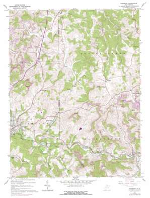
Rosemont Topo Map West Virginia
To zoom in, hover over the map of Rosemont
USGS Topo Quad 39080c2 - 1:24,000 scale
| Topo Map Name: | Rosemont |
| USGS Topo Quad ID: | 39080c2 |
| Print Size: | ca. 21 1/4" wide x 27" high |
| Southeast Coordinates: | 39.25° N latitude / 80.125° W longitude |
| Map Center Coordinates: | 39.3125° N latitude / 80.1875° W longitude |
| U.S. State: | WV |
| Filename: | o39080c2.jpg |
| Download Map JPG Image: | Rosemont topo map 1:24,000 scale |
| Map Type: | Topographic |
| Topo Series: | 7.5´ |
| Map Scale: | 1:24,000 |
| Source of Map Images: | United States Geological Survey (USGS) |
| Alternate Map Versions: |
Rosemont WV 1960, updated 1962 Download PDF Buy paper map Rosemont WV 1960, updated 1972 Download PDF Buy paper map Rosemont WV 1960, updated 1978 Download PDF Buy paper map Rosemont WV 2011 Download PDF Buy paper map Rosemont WV 2014 Download PDF Buy paper map Rosemont WV 2016 Download PDF Buy paper map |
1:24,000 Topo Quads surrounding Rosemont
> Back to 39080a1 at 1:100,000 scale
> Back to 39080a1 at 1:250,000 scale
> Back to U.S. Topo Maps home
Rosemont topo map: Gazetteer
Rosemont: Airports
Benedum Airport elevation 362m 1187′Rosemont: Crossings
Interchange 125 elevation 328m 1076′Rosemont: Dams
Deegan Lake Dam elevation 317m 1040′Maple Lake Dam elevation 320m 1049′
Rosemont: Parks
Hinkle-Deegan Park elevation 318m 1043′Rosemont: Populated Places
Flemington elevation 310m 1017′Hepzibah elevation 354m 1161′
Lake Ridge elevation 354m 1161′
Maple Lake elevation 329m 1079′
McAlpin elevation 347m 1138′
McGee elevation 416m 1364′
Meadland elevation 401m 1315′
Middleville elevation 348m 1141′
Oral Lake elevation 308m 1010′
Oreide elevation 320m 1049′
Rosemont elevation 306m 1003′
Ryanville elevation 330m 1082′
Santiago elevation 315m 1033′
Rosemont: Post Offices
Rosemont Post Office elevation 306m 1003′Rosemont: Ridges
Curry Ridge elevation 465m 1525′Rosemont: Springs
Dennis Cather Spring elevation 373m 1223′Rosemont: Streams
Beards Run elevation 316m 1036′Berry Run elevation 307m 1007′
Corbin Branch elevation 305m 1000′
Douglas Run elevation 301m 987′
Jerry Run elevation 300m 984′
Peddler Run elevation 296m 971′
Plummer Run elevation 313m 1026′
Right Fork Simpson Creek elevation 307m 1007′
Sugarcamp Run elevation 316m 1036′
Thomas Fork elevation 302m 990′
Turkey Run elevation 311m 1020′
Rosemont: Summits
Bald Knob elevation 473m 1551′Copeland Knob elevation 541m 1774′
Patton Knob elevation 482m 1581′
Pewee Knob elevation 512m 1679′
Plummer Knob elevation 505m 1656′
Rosemont: Valleys
Stout Hollow elevation 324m 1062′Rosemont digital topo map on disk
Buy this Rosemont topo map showing relief, roads, GPS coordinates and other geographical features, as a high-resolution digital map file on DVD:


