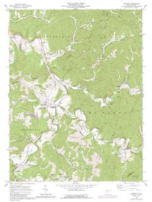
Shirley Topo Map West Virginia
To zoom in, hover over the map of Shirley
USGS Topo Quad 39080d7 - 1:24,000 scale
| Topo Map Name: | Shirley |
| USGS Topo Quad ID: | 39080d7 |
| Print Size: | ca. 21 1/4" wide x 27" high |
| Southeast Coordinates: | 39.375° N latitude / 80.75° W longitude |
| Map Center Coordinates: | 39.4375° N latitude / 80.8125° W longitude |
| U.S. State: | WV |
| Filename: | o39080d7.jpg |
| Download Map JPG Image: | Shirley topo map 1:24,000 scale |
| Map Type: | Topographic |
| Topo Series: | 7.5´ |
| Map Scale: | 1:24,000 |
| Source of Map Images: | United States Geological Survey (USGS) |
| Alternate Map Versions: |
Shirley WV 1961, updated 1963 Download PDF Buy paper map Shirley WV 1961, updated 1975 Download PDF Buy paper map Shirley WV 1961, updated 1989 Download PDF Buy paper map Shirley WV 1976, updated 1979 Download PDF Buy paper map Shirley WV 2011 Download PDF Buy paper map Shirley WV 2014 Download PDF Buy paper map Shirley WV 2016 Download PDF Buy paper map |
1:24,000 Topo Quads surrounding Shirley
> Back to 39080a1 at 1:100,000 scale
> Back to 39080a1 at 1:250,000 scale
> Back to U.S. Topo Maps home
Shirley topo map: Gazetteer
Shirley: Dams
Conaway Run Dam elevation 236m 774′Shirley: Parks
Conaway Run Wildlife Management Area elevation 247m 810′Jug Wildlife Management Area elevation 245m 803′
Shirley: Populated Places
Akron elevation 242m 793′Big Moses elevation 220m 721′
Blue elevation 214m 702′
Booher elevation 226m 741′
Centerville elevation 233m 764′
Frew elevation 212m 695′
Meeker elevation 234m 767′
Shirley elevation 220m 721′
Sunnyside elevation 225m 738′
Tyler elevation 230m 754′
Wilbur elevation 314m 1030′
Shirley: Post Offices
Shirley Post Office elevation 221m 725′Shirley: Ridges
Blue Ridge elevation 384m 1259′Shirley: Streams
Big Run elevation 216m 708′Big Run elevation 213m 698′
Blue Run elevation 208m 682′
Booher Run elevation 221m 725′
Camp Run elevation 219m 718′
Conaway Run elevation 212m 695′
Doe Run elevation 221m 725′
Elder Run elevation 231m 757′
Groves Run elevation 217m 711′
Indian Creek elevation 209m 685′
Jefferson Run elevation 211m 692′
Labell Run elevation 216m 708′
Little Camp Mistake Run elevation 219m 718′
Mackey Run elevation 218m 715′
McElroy Creek elevation 209m 685′
McGee Run elevation 214m 702′
Morrison Run elevation 216m 708′
Muddy Creek elevation 207m 679′
Pitts Run elevation 218m 715′
Pratt Run elevation 217m 711′
Purgatory Run elevation 215m 705′
Ross Run elevation 215m 705′
Sandy Run elevation 219m 718′
Wheeler Run elevation 210m 688′
Woodburn Run elevation 226m 741′
Shirley digital topo map on disk
Buy this Shirley topo map showing relief, roads, GPS coordinates and other geographical features, as a high-resolution digital map file on DVD:


