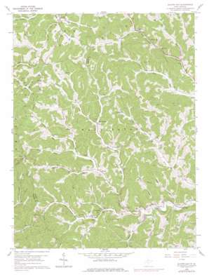
Glover Gap Topo Map West Virginia
To zoom in, hover over the map of Glover Gap
USGS Topo Quad 39080e4 - 1:24,000 scale
| Topo Map Name: | Glover Gap |
| USGS Topo Quad ID: | 39080e4 |
| Print Size: | ca. 21 1/4" wide x 27" high |
| Southeast Coordinates: | 39.5° N latitude / 80.375° W longitude |
| Map Center Coordinates: | 39.5625° N latitude / 80.4375° W longitude |
| U.S. State: | WV |
| Filename: | o39080e4.jpg |
| Download Map JPG Image: | Glover Gap topo map 1:24,000 scale |
| Map Type: | Topographic |
| Topo Series: | 7.5´ |
| Map Scale: | 1:24,000 |
| Source of Map Images: | United States Geological Survey (USGS) |
| Alternate Map Versions: |
Glover Gap WV 1960, updated 1962 Download PDF Buy paper map Glover Gap WV 1960, updated 1965 Download PDF Buy paper map Glover Gap WV 1960, updated 1977 Download PDF Buy paper map Glover Gap WV 2011 Download PDF Buy paper map Glover Gap WV 2014 Download PDF Buy paper map Glover Gap WV 2016 Download PDF Buy paper map |
1:24,000 Topo Quads surrounding Glover Gap
> Back to 39080e1 at 1:100,000 scale
> Back to 39080a1 at 1:250,000 scale
> Back to U.S. Topo Maps home
Glover Gap topo map: Gazetteer
Glover Gap: Dams
Upper Buffalo Creek Structure Number 22 Dam elevation 336m 1102′Upper Buffalo Creek Structure Number Two Dam elevation 307m 1007′
Whetstone A M D Dam elevation 312m 1023′
Glover Gap: Populated Places
Brink elevation 430m 1410′Curtisville elevation 308m 1010′
Deep Valley elevation 302m 990′
Earnshaw elevation 326m 1069′
Logansport elevation 305m 1000′
Rymer elevation 312m 1023′
Satterfield (historical) elevation 313m 1026′
Seven Pines elevation 324m 1062′
Glover Gap: Springs
Charles Beatty Spring elevation 318m 1043′George Williams Spring elevation 427m 1400′
Glover Gap: Streams
Bartholomew Fork elevation 306m 1003′Beechlick Run elevation 323m 1059′
Big Jim Run elevation 327m 1072′
Big Run elevation 310m 1017′
Brush Run elevation 301m 987′
Camp Run elevation 310m 1017′
Evans Run elevation 316m 1036′
Harker Run elevation 327m 1072′
Hibbs Run elevation 306m 1003′
Higginbotham Run elevation 329m 1079′
Huey Run elevation 300m 984′
Joes Run elevation 299m 980′
Laurel Run elevation 308m 1010′
Long Drain elevation 300m 984′
Owen Davy Fork elevation 302m 990′
Price Run elevation 298m 977′
Rex Run elevation 314m 1030′
Starkey Run elevation 318m 1043′
Warrior Fork elevation 311m 1020′
Glover Gap digital topo map on disk
Buy this Glover Gap topo map showing relief, roads, GPS coordinates and other geographical features, as a high-resolution digital map file on DVD:


