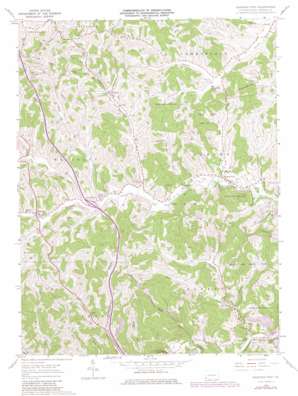
Garards Fort Topo Map Pennsylvania
To zoom in, hover over the map of Garards Fort
USGS Topo Quad 39080g1 - 1:24,000 scale
| Topo Map Name: | Garards Fort |
| USGS Topo Quad ID: | 39080g1 |
| Print Size: | ca. 21 1/4" wide x 27" high |
| Southeast Coordinates: | 39.75° N latitude / 80° W longitude |
| Map Center Coordinates: | 39.8125° N latitude / 80.0625° W longitude |
| U.S. State: | PA |
| Filename: | o39080g1.jpg |
| Download Map JPG Image: | Garards Fort topo map 1:24,000 scale |
| Map Type: | Topographic |
| Topo Series: | 7.5´ |
| Map Scale: | 1:24,000 |
| Source of Map Images: | United States Geological Survey (USGS) |
| Alternate Map Versions: |
Garards Fort PA 1961, updated 1963 Download PDF Buy paper map Garards Fort PA 1961, updated 1972 Download PDF Buy paper map Garards Fort PA 1961, updated 1973 Download PDF Buy paper map Garards Fort PA 1961, updated 1979 Download PDF Buy paper map Garards Fort PA 2010 Download PDF Buy paper map Garards Fort PA 2013 Download PDF Buy paper map Garards Fort PA 2016 Download PDF Buy paper map |
1:24,000 Topo Quads surrounding Garards Fort
> Back to 39080e1 at 1:100,000 scale
> Back to 39080a1 at 1:250,000 scale
> Back to U.S. Topo Maps home
Garards Fort topo map: Gazetteer
Garards Fort: Mines
Bowlby Shaft elevation 318m 1043′Long Shaft elevation 343m 1125′
Garards Fort: Parks
State Game Lands Number 223 elevation 408m 1338′Garards Fort: Populated Places
Davistown elevation 286m 938′Fordyce elevation 314m 1030′
Garards Fort elevation 296m 971′
Kirby elevation 321m 1053′
Garards Fort: Reservoirs
Asbury Church elevation 310m 1017′Garards Fort: Streams
Bell Run elevation 296m 971′Dutch Run elevation 300m 984′
Dyers Fork elevation 305m 1000′
Frosty Run elevation 308m 1010′
Glade Run elevation 271m 889′
Meadow Run elevation 266m 872′
Minor Run elevation 288m 944′
North Branch Calvin Run elevation 297m 974′
Roberts Run elevation 281m 921′
Woods Run elevation 295m 967′
Garards Fort digital topo map on disk
Buy this Garards Fort topo map showing relief, roads, GPS coordinates and other geographical features, as a high-resolution digital map file on DVD:


