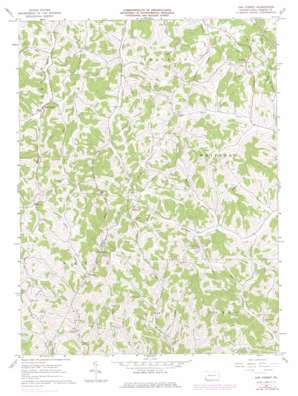
Oak Forest Topo Map Pennsylvania
To zoom in, hover over the map of Oak Forest
USGS Topo Quad 39080g2 - 1:24,000 scale
| Topo Map Name: | Oak Forest |
| USGS Topo Quad ID: | 39080g2 |
| Print Size: | ca. 21 1/4" wide x 27" high |
| Southeast Coordinates: | 39.75° N latitude / 80.125° W longitude |
| Map Center Coordinates: | 39.8125° N latitude / 80.1875° W longitude |
| U.S. State: | PA |
| Filename: | o39080g2.jpg |
| Download Map JPG Image: | Oak Forest topo map 1:24,000 scale |
| Map Type: | Topographic |
| Topo Series: | 7.5´ |
| Map Scale: | 1:24,000 |
| Source of Map Images: | United States Geological Survey (USGS) |
| Alternate Map Versions: |
Oak Forest PA 1961, updated 1963 Download PDF Buy paper map Oak Forest PA 1961, updated 1971 Download PDF Buy paper map Oak Forest PA 1961, updated 1973 Download PDF Buy paper map Oak Forest PA 1961, updated 1979 Download PDF Buy paper map Oak Forest PA 2010 Download PDF Buy paper map Oak Forest PA 2013 Download PDF Buy paper map Oak Forest PA 2016 Download PDF Buy paper map |
1:24,000 Topo Quads surrounding Oak Forest
> Back to 39080e1 at 1:100,000 scale
> Back to 39080a1 at 1:250,000 scale
> Back to U.S. Topo Maps home
Oak Forest topo map: Gazetteer
Oak Forest: Populated Places
Brant Hill elevation 445m 1459′Gump elevation 417m 1368′
Oak Forest elevation 307m 1007′
Spraggs elevation 325m 1066′
Oak Forest: Streams
Calico Run elevation 322m 1056′Haynes Run elevation 305m 1000′
Maple Run elevation 305m 1000′
Mount Phoebe Run elevation 309m 1013′
Patterson Run elevation 319m 1046′
Stewart Run elevation 302m 990′
Woods Run elevation 295m 967′
Oak Forest digital topo map on disk
Buy this Oak Forest topo map showing relief, roads, GPS coordinates and other geographical features, as a high-resolution digital map file on DVD:


