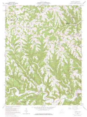
Cameron Topo Map Ohio
To zoom in, hover over the map of Cameron
USGS Topo Quad 39080g8 - 1:24,000 scale
| Topo Map Name: | Cameron |
| USGS Topo Quad ID: | 39080g8 |
| Print Size: | ca. 21 1/4" wide x 27" high |
| Southeast Coordinates: | 39.75° N latitude / 80.875° W longitude |
| Map Center Coordinates: | 39.8125° N latitude / 80.9375° W longitude |
| U.S. State: | OH |
| Filename: | o39080g8.jpg |
| Download Map JPG Image: | Cameron topo map 1:24,000 scale |
| Map Type: | Topographic |
| Topo Series: | 7.5´ |
| Map Scale: | 1:24,000 |
| Source of Map Images: | United States Geological Survey (USGS) |
| Alternate Map Versions: |
Cameron OH 1960, updated 1962 Download PDF Buy paper map Cameron OH 1960, updated 1966 Download PDF Buy paper map Cameron OH 1960, updated 1973 Download PDF Buy paper map Cameron OH 1960, updated 1977 Download PDF Buy paper map Cameron OH 1994, updated 1998 Download PDF Buy paper map Cameron OH 2010 Download PDF Buy paper map Cameron OH 2013 Download PDF Buy paper map Cameron OH 2016 Download PDF Buy paper map |
1:24,000 Topo Quads surrounding Cameron
> Back to 39080e1 at 1:100,000 scale
> Back to 39080a1 at 1:250,000 scale
> Back to U.S. Topo Maps home
Cameron topo map: Gazetteer
Cameron: Populated Places
Bingham elevation 397m 1302′Cameron elevation 209m 685′
Clover Hill elevation 408m 1338′
Dwight elevation 380m 1246′
Switzer elevation 379m 1243′
Cameron: Post Offices
Bingham Post Office (historical) elevation 393m 1289′Dwight Post Office (historical) elevation 389m 1276′
Switzer Post Office (historical) elevation 378m 1240′
Cameron: Ridges
Brock Ridge elevation 399m 1309′Cane Ridge elevation 403m 1322′
Case Ridge elevation 409m 1341′
Clover Ridge elevation 389m 1276′
Dover Ridge elevation 397m 1302′
Dry Ridge elevation 405m 1328′
Headley Ridge elevation 389m 1276′
Irish Ridge elevation 379m 1243′
Mellott Ridge elevation 399m 1309′
Pfalzgraf Ridge elevation 367m 1204′
Yellow Ridge elevation 378m 1240′
Cameron: Streams
Ackerson Run elevation 207m 679′Paine Run elevation 207m 679′
Salem Run elevation 187m 613′
Cameron: Summits
Kanzigg Hill elevation 398m 1305′Cameron digital topo map on disk
Buy this Cameron topo map showing relief, roads, GPS coordinates and other geographical features, as a high-resolution digital map file on DVD:


