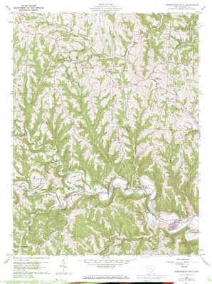
Armstrongs Mills Topo Map Ohio
To zoom in, hover over the map of Armstrongs Mills
USGS Topo Quad 39080h8 - 1:24,000 scale
| Topo Map Name: | Armstrongs Mills |
| USGS Topo Quad ID: | 39080h8 |
| Print Size: | ca. 21 1/4" wide x 27" high |
| Southeast Coordinates: | 39.875° N latitude / 80.875° W longitude |
| Map Center Coordinates: | 39.9375° N latitude / 80.9375° W longitude |
| U.S. State: | OH |
| Filename: | o39080h8.jpg |
| Download Map JPG Image: | Armstrongs Mills topo map 1:24,000 scale |
| Map Type: | Topographic |
| Topo Series: | 7.5´ |
| Map Scale: | 1:24,000 |
| Source of Map Images: | United States Geological Survey (USGS) |
| Alternate Map Versions: |
Armstrongs Mills OH 1960, updated 1961 Download PDF Buy paper map Armstrongs Mills OH 1960, updated 1973 Download PDF Buy paper map Armstrongs Mills OH 2010 Download PDF Buy paper map Armstrongs Mills OH 2013 Download PDF Buy paper map Armstrongs Mills OH 2016 Download PDF Buy paper map |
1:24,000 Topo Quads surrounding Armstrongs Mills
> Back to 39080e1 at 1:100,000 scale
> Back to 39080a1 at 1:250,000 scale
> Back to U.S. Topo Maps home
Armstrongs Mills topo map: Gazetteer
Armstrongs Mills: Dams
Nacco Slurry Refuse Disposal Dam elevation 328m 1076′Armstrongs Mills: Populated Places
Alledonia elevation 253m 830′Armstrongs Mills elevation 231m 757′
Becket (historical) elevation 363m 1190′
Centerville elevation 396m 1299′
Crabapple elevation 285m 935′
Dorsey (historical) elevation 245m 803′
Hogsink elevation 251m 823′
Jacobsburg elevation 395m 1295′
Kelsey (historical) elevation 409m 1341′
Armstrongs Mills: Post Offices
Alledonia Post Office elevation 253m 830′Armstrongs Mills Post Office elevation 229m 751′
Dorsey Post Office (historical) elevation 245m 803′
Jacobsburg Post Office elevation 396m 1299′
Kelsey Post Office (historical) elevation 410m 1345′
Armstrongs Mills: Reservoirs
Nacco Slurry Refuse Impoundment elevation 328m 1076′Armstrongs Mills: Ridges
Pugh Ridge elevation 409m 1341′Armstrongs Mills: Streams
Anderson Run elevation 231m 757′Bend Fork elevation 236m 774′
Crabapple Creek elevation 247m 810′
Joy Fork elevation 273m 895′
Millers Run elevation 267m 875′
Moore Run elevation 211m 692′
Pea Vine Creek elevation 227m 744′
Piney Creek elevation 253m 830′
Rocky Fork elevation 224m 734′
Armstrongs Mills: Summits
Cool Hill elevation 388m 1272′Armstrongs Mills digital topo map on disk
Buy this Armstrongs Mills topo map showing relief, roads, GPS coordinates and other geographical features, as a high-resolution digital map file on DVD:


