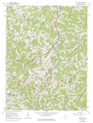
Rockport Topo Map West Virginia
To zoom in, hover over the map of Rockport
USGS Topo Quad 39081a5 - 1:24,000 scale
| Topo Map Name: | Rockport |
| USGS Topo Quad ID: | 39081a5 |
| Print Size: | ca. 21 1/4" wide x 27" high |
| Southeast Coordinates: | 39° N latitude / 81.5° W longitude |
| Map Center Coordinates: | 39.0625° N latitude / 81.5625° W longitude |
| U.S. State: | WV |
| Filename: | o39081a5.jpg |
| Download Map JPG Image: | Rockport topo map 1:24,000 scale |
| Map Type: | Topographic |
| Topo Series: | 7.5´ |
| Map Scale: | 1:24,000 |
| Source of Map Images: | United States Geological Survey (USGS) |
| Alternate Map Versions: |
Rockport WV 1960, updated 1963 Download PDF Buy paper map Rockport WV 1960, updated 1977 Download PDF Buy paper map Rockport WV 2010 Download PDF Buy paper map Rockport WV 2014 Download PDF Buy paper map Rockport WV 2016 Download PDF Buy paper map |
1:24,000 Topo Quads surrounding Rockport
> Back to 39081a1 at 1:100,000 scale
> Back to 39080a1 at 1:250,000 scale
> Back to U.S. Topo Maps home
Rockport topo map: Gazetteer
Rockport: Populated Places
Lowdell elevation 200m 656′McKinley (historical) elevation 347m 1138′
Rockport elevation 215m 705′
Saulsbury elevation 192m 629′
Windy elevation 335m 1099′
Rockport: Ridges
Bogal Ridge elevation 314m 1030′Brown Ridge elevation 329m 1079′
Central Ridge elevation 330m 1082′
Courtney Ridge elevation 339m 1112′
Dutch Ridge elevation 307m 1007′
Gates Ridge elevation 330m 1082′
Kiser Ridge elevation 326m 1069′
Limestone Ridge elevation 343m 1125′
Stephens Ridge elevation 325m 1066′
Rockport: Streams
Ash Lick Run elevation 207m 679′Big Indian Run elevation 208m 682′
Buck Run elevation 205m 672′
Buck Run elevation 196m 643′
Buffalo Run elevation 196m 643′
Burns Run elevation 212m 695′
Fivemile Run elevation 198m 649′
Joes Run elevation 197m 646′
Joshus Fork elevation 198m 649′
Left Fork Slate Creek elevation 209m 685′
Little Indian Run elevation 213m 698′
Mail Point Run elevation 219m 718′
Mannon Run elevation 202m 662′
Ratcliff Run elevation 193m 633′
Right Fork Slate Creek elevation 210m 688′
Right Fork Tucker Creek elevation 212m 695′
Rockcamp Run elevation 217m 711′
Sandy Run elevation 200m 656′
Skull Run elevation 203m 666′
Rockport: Summits
Mail Point Hill elevation 348m 1141′Stephens Knob elevation 329m 1079′
Rockport: Valleys
Nicholas Hollow elevation 200m 656′Queen Hollow elevation 209m 685′
Rockport digital topo map on disk
Buy this Rockport topo map showing relief, roads, GPS coordinates and other geographical features, as a high-resolution digital map file on DVD:


