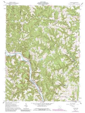
Cutler Topo Map Ohio
To zoom in, hover over the map of Cutler
USGS Topo Quad 39081c7 - 1:24,000 scale
| Topo Map Name: | Cutler |
| USGS Topo Quad ID: | 39081c7 |
| Print Size: | ca. 21 1/4" wide x 27" high |
| Southeast Coordinates: | 39.25° N latitude / 81.75° W longitude |
| Map Center Coordinates: | 39.3125° N latitude / 81.8125° W longitude |
| U.S. State: | OH |
| Filename: | o39081c7.jpg |
| Download Map JPG Image: | Cutler topo map 1:24,000 scale |
| Map Type: | Topographic |
| Topo Series: | 7.5´ |
| Map Scale: | 1:24,000 |
| Source of Map Images: | United States Geological Survey (USGS) |
| Alternate Map Versions: |
Cutler OH 1961, updated 1963 Download PDF Buy paper map Cutler OH 1961, updated 1963 Download PDF Buy paper map Cutler OH 1961, updated 1990 Download PDF Buy paper map Cutler OH 1994, updated 1998 Download PDF Buy paper map Cutler OH 2002, updated 2006 Download PDF Buy paper map Cutler OH 2011 Download PDF Buy paper map Cutler OH 2013 Download PDF Buy paper map Cutler OH 2016 Download PDF Buy paper map |
| FStopo: | US Forest Service topo Cutler is available: Download FStopo PDF Download FStopo TIF |
1:24,000 Topo Quads surrounding Cutler
> Back to 39081a1 at 1:100,000 scale
> Back to 39080a1 at 1:250,000 scale
> Back to U.S. Topo Maps home
Cutler topo map: Gazetteer
Cutler: Arches
Rock Bridge elevation 241m 790′Cutler: Bridges
Root Bridge elevation 192m 629′Cutler: Dams
Badger Lake Dam elevation 251m 823′Cutler: Populated Places
Beebe elevation 183m 600′Big Run elevation 183m 600′
Cutler elevation 246m 807′
Decaturville elevation 250m 820′
Frost elevation 183m 600′
Ireland elevation 237m 777′
Qualey elevation 230m 754′
Cutler: Post Offices
Frost Post Office (historical) elevation 177m 580′Cutler: Reservoirs
Badger Lake elevation 251m 823′Cutler: Ridges
Cubbison Ridge elevation 263m 862′Haga Ridge elevation 283m 928′
Cutler: Streams
Bogie Run elevation 191m 626′Burnett Run elevation 190m 623′
Dark Cave Run elevation 188m 616′
Ellis Run elevation 188m 616′
Falls Creek elevation 199m 652′
Gilbert Run elevation 188m 616′
Hatch Fork Big Run elevation 188m 616′
Joes Run elevation 187m 613′
Jordan Run elevation 177m 580′
Laurel Run elevation 180m 590′
Lead Run elevation 177m 580′
Long Run elevation 206m 675′
Longs Run elevation 181m 593′
Nellis Run elevation 187m 613′
Rowell Run elevation 176m 577′
South Fork Gilbert Run elevation 193m 633′
South Fork Laurel Run elevation 183m 600′
Twomile Run elevation 183m 600′
Wildcat Run elevation 203m 666′
Cutler: Valleys
Bogie Hollow elevation 191m 626′Cutler digital topo map on disk
Buy this Cutler topo map showing relief, roads, GPS coordinates and other geographical features, as a high-resolution digital map file on DVD:


