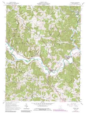
Stewart Topo Map Ohio
To zoom in, hover over the map of Stewart
USGS Topo Quad 39081c8 - 1:24,000 scale
| Topo Map Name: | Stewart |
| USGS Topo Quad ID: | 39081c8 |
| Print Size: | ca. 21 1/4" wide x 27" high |
| Southeast Coordinates: | 39.25° N latitude / 81.875° W longitude |
| Map Center Coordinates: | 39.3125° N latitude / 81.9375° W longitude |
| U.S. State: | OH |
| Filename: | o39081c8.jpg |
| Download Map JPG Image: | Stewart topo map 1:24,000 scale |
| Map Type: | Topographic |
| Topo Series: | 7.5´ |
| Map Scale: | 1:24,000 |
| Source of Map Images: | United States Geological Survey (USGS) |
| Alternate Map Versions: |
Stewart OH 1961, updated 1962 Download PDF Buy paper map Stewart OH 1961, updated 1974 Download PDF Buy paper map Stewart OH 1961, updated 1984 Download PDF Buy paper map Stewart OH 1961, updated 1990 Download PDF Buy paper map Stewart OH 1994, updated 1998 Download PDF Buy paper map Stewart OH 2002, updated 2006 Download PDF Buy paper map Stewart OH 2011 Download PDF Buy paper map Stewart OH 2013 Download PDF Buy paper map Stewart OH 2016 Download PDF Buy paper map |
| FStopo: | US Forest Service topo Stewart is available: Download FStopo PDF Download FStopo TIF |
1:24,000 Topo Quads surrounding Stewart
> Back to 39081a1 at 1:100,000 scale
> Back to 39080a1 at 1:250,000 scale
> Back to U.S. Topo Maps home
Stewart topo map: Gazetteer
Stewart: Lakes
Rays Lakes elevation 196m 643′Stewart: Populated Places
Broadwell elevation 189m 620′Canaanville elevation 191m 626′
Cole elevation 188m 616′
Guysville elevation 196m 643′
Hull elevation 244m 800′
Kilvert elevation 195m 639′
New England elevation 243m 797′
Stewart elevation 203m 666′
Stringtown elevation 193m 633′
Stewart: Post Offices
Broadwell Post Office (historical) elevation 188m 616′Guysville Post Office elevation 202m 662′
Hull Post Office (historical) elevation 248m 813′
Kilvert Post Office (historical) elevation 181m 593′
New England Post Office (historical) elevation 242m 793′
Stewart Post Office elevation 201m 659′
Stewart: Streams
Big Run elevation 183m 600′Buckley Run elevation 189m 620′
Butts Run elevation 183m 600′
Canaanville Run elevation 188m 616′
Dutch Creek elevation 204m 669′
Federal Creek elevation 179m 587′
Green Run elevation 183m 600′
Herrold Run elevation 180m 590′
Lick Run elevation 189m 620′
Marietta Run elevation 185m 606′
Miller Run elevation 182m 597′
Piper Run elevation 183m 600′
Riley Run elevation 203m 666′
Rocky Run elevation 186m 610′
Scott Creek elevation 193m 633′
Sharps Run elevation 181m 593′
Spruce Run elevation 182m 597′
Tiger Run elevation 183m 600′
Willow Creek elevation 184m 603′
Stewart: Summits
Riley Hill elevation 294m 964′Stewart digital topo map on disk
Buy this Stewart topo map showing relief, roads, GPS coordinates and other geographical features, as a high-resolution digital map file on DVD:


