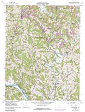
Lower Salem Topo Map Ohio
To zoom in, hover over the map of Lower Salem
USGS Topo Quad 39081e4 - 1:24,000 scale
| Topo Map Name: | Lower Salem |
| USGS Topo Quad ID: | 39081e4 |
| Print Size: | ca. 21 1/4" wide x 27" high |
| Southeast Coordinates: | 39.5° N latitude / 81.375° W longitude |
| Map Center Coordinates: | 39.5625° N latitude / 81.4375° W longitude |
| U.S. State: | OH |
| Filename: | o39081e4.jpg |
| Download Map JPG Image: | Lower Salem topo map 1:24,000 scale |
| Map Type: | Topographic |
| Topo Series: | 7.5´ |
| Map Scale: | 1:24,000 |
| Source of Map Images: | United States Geological Survey (USGS) |
| Alternate Map Versions: |
Lower Salem OH 1961, updated 1963 Download PDF Buy paper map Lower Salem OH 1961, updated 1973 Download PDF Buy paper map Lower Salem OH 1961, updated 1986 Download PDF Buy paper map Lower Salem OH 1994, updated 1998 Download PDF Buy paper map Lower Salem OH 2010 Download PDF Buy paper map Lower Salem OH 2013 Download PDF Buy paper map Lower Salem OH 2016 Download PDF Buy paper map |
1:24,000 Topo Quads surrounding Lower Salem
> Back to 39081e1 at 1:100,000 scale
> Back to 39080a1 at 1:250,000 scale
> Back to U.S. Topo Maps home
Lower Salem topo map: Gazetteer
Lower Salem: Populated Places
Bonn elevation 267m 875′Buells (historical) elevation 183m 600′
Elba elevation 206m 675′
Honesty elevation 240m 787′
Kilmer elevation 206m 675′
Lower Salem elevation 198m 649′
Warner elevation 206m 675′
Whipple elevation 197m 646′
Lower Salem: Post Offices
Honesty Post Office (historical) elevation 244m 800′Kilmer Post Office (historical) elevation 213m 698′
Lower Salem: Ridges
Dixon Ridge elevation 291m 954′Lower Salem: Streams
Bear Creek elevation 182m 597′East Fork Duck Creek elevation 194m 636′
New Years Creek elevation 188m 616′
Pawpaw Creek elevation 195m 639′
West Fork Duck Creek elevation 196m 643′
Lower Salem digital topo map on disk
Buy this Lower Salem topo map showing relief, roads, GPS coordinates and other geographical features, as a high-resolution digital map file on DVD:


