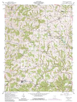
Lewisville Topo Map Ohio
To zoom in, hover over the map of Lewisville
USGS Topo Quad 39081g2 - 1:24,000 scale
| Topo Map Name: | Lewisville |
| USGS Topo Quad ID: | 39081g2 |
| Print Size: | ca. 21 1/4" wide x 27" high |
| Southeast Coordinates: | 39.75° N latitude / 81.125° W longitude |
| Map Center Coordinates: | 39.8125° N latitude / 81.1875° W longitude |
| U.S. State: | OH |
| Filename: | o39081g2.jpg |
| Download Map JPG Image: | Lewisville topo map 1:24,000 scale |
| Map Type: | Topographic |
| Topo Series: | 7.5´ |
| Map Scale: | 1:24,000 |
| Source of Map Images: | United States Geological Survey (USGS) |
| Alternate Map Versions: |
Lewisville OH 1961, updated 1963 Download PDF Buy paper map Lewisville OH 1961, updated 1990 Download PDF Buy paper map Lewisville OH 1994, updated 1998 Download PDF Buy paper map Lewisville OH 2002, updated 2006 Download PDF Buy paper map Lewisville OH 2011 Download PDF Buy paper map Lewisville OH 2013 Download PDF Buy paper map Lewisville OH 2016 Download PDF Buy paper map |
| FStopo: | US Forest Service topo Lewisville is available: Download FStopo PDF Download FStopo TIF |
1:24,000 Topo Quads surrounding Lewisville
> Back to 39081e1 at 1:100,000 scale
> Back to 39080a1 at 1:250,000 scale
> Back to U.S. Topo Maps home
Lewisville topo map: Gazetteer
Lewisville: Airports
Woodsfield Heliport elevation 365m 1197′Lewisville: Dams
Monroe Lake Dam elevation 328m 1076′Stires Lake Dam elevation 349m 1145′
Lewisville: Parks
Monroe Lake State Wildlife Area elevation 373m 1223′Lewisville: Populated Places
Decker elevation 389m 1276′Hamilton elevation 305m 1000′
Jacobsburg elevation 366m 1200′
Kerr elevation 360m 1181′
Lewisville elevation 366m 1200′
Malaga elevation 402m 1318′
Miltonsburg elevation 395m 1295′
Monroefield elevation 376m 1233′
Lewisville: Post Offices
Malaga Post Office elevation 400m 1312′Monroefield Post Office (historical) elevation 378m 1240′
Lewisville: Reservoirs
Monroe Lake elevation 328m 1076′Stires Lake elevation 349m 1145′
Lewisville: Streams
Rock Creek elevation 273m 895′Wheeler Run elevation 295m 967′
Lewisville digital topo map on disk
Buy this Lewisville topo map showing relief, roads, GPS coordinates and other geographical features, as a high-resolution digital map file on DVD:


