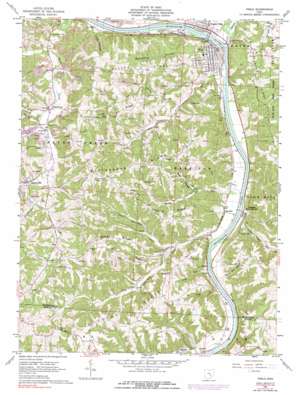
Philo Topo Map Ohio
To zoom in, hover over the map of Philo
USGS Topo Quad 39081g8 - 1:24,000 scale
| Topo Map Name: | Philo |
| USGS Topo Quad ID: | 39081g8 |
| Print Size: | ca. 21 1/4" wide x 27" high |
| Southeast Coordinates: | 39.75° N latitude / 81.875° W longitude |
| Map Center Coordinates: | 39.8125° N latitude / 81.9375° W longitude |
| U.S. State: | OH |
| Filename: | o39081g8.jpg |
| Download Map JPG Image: | Philo topo map 1:24,000 scale |
| Map Type: | Topographic |
| Topo Series: | 7.5´ |
| Map Scale: | 1:24,000 |
| Source of Map Images: | United States Geological Survey (USGS) |
| Alternate Map Versions: |
Philo OH 1961, updated 1963 Download PDF Buy paper map Philo OH 1961, updated 1973 Download PDF Buy paper map Philo OH 1961, updated 1977 Download PDF Buy paper map Philo OH 1961, updated 1990 Download PDF Buy paper map Philo OH 1994, updated 1998 Download PDF Buy paper map Philo OH 2010 Download PDF Buy paper map Philo OH 2013 Download PDF Buy paper map Philo OH 2016 Download PDF Buy paper map |
1:24,000 Topo Quads surrounding Philo
> Back to 39081e1 at 1:100,000 scale
> Back to 39080a1 at 1:250,000 scale
> Back to U.S. Topo Maps home
Philo topo map: Gazetteer
Philo: Dams
Muskingum River Lock and Dam Number Nine elevation 205m 672′Philo: Populated Places
Blue Rock elevation 219m 718′Brush Creek elevation 239m 784′
Cannelville elevation 227m 744′
Cedar Run elevation 204m 669′
Duncan Falls elevation 219m 718′
Durant elevation 206m 675′
Gaysport elevation 216m 708′
Merriam elevation 200m 656′
Philo elevation 224m 734′
Sealover (historical) elevation 213m 698′
Stone elevation 207m 679′
Stovertown elevation 219m 718′
White Eyes Town (historical) elevation 220m 721′
Philo: Post Offices
Blue Rock Post Office elevation 216m 708′Blue Rock Post Office elevation 217m 711′
Cannelville Post Office (historical) elevation 228m 748′
Cedarrun Post Office (historical) elevation 204m 669′
Duncan Falls Post Office elevation 219m 718′
Durant Post Office (historical) elevation 206m 675′
Gaysport Post Office (historical) elevation 211m 692′
Philo Post Office elevation 218m 715′
Sealover Post Office (historical) elevation 211m 692′
Sealover Post Office (historical) elevation 211m 692′
Stovertown Post Office (historical) elevation 220m 721′
Philo: Reservoirs
Muskingum River Lock and Dam Number elevation 205m 672′Philo: Ridges
Butterbean Ridge elevation 308m 1010′Dozer Ridge elevation 307m 1007′
Fatler Ridge elevation 280m 918′
Irish Ridge elevation 277m 908′
Poverty Ridge elevation 307m 1007′
Sharp Ridge elevation 305m 1000′
Staker Ridge elevation 310m 1017′
Virginia Ridge elevation 304m 997′
Philo: Streams
Back Run elevation 202m 662′Baughman Run elevation 219m 718′
Blue Rock Creek elevation 196m 643′
Cedar Run elevation 203m 666′
Crow Run elevation 203m 666′
Dry Riffle Run elevation 207m 679′
Duncan Run elevation 206m 675′
Fox Run elevation 196m 643′
Goose Run elevation 230m 754′
Little Blue Rock Creek elevation 215m 705′
Little Duncan Run elevation 208m 682′
Salt Creek elevation 207m 679′
Sycamore Run elevation 207m 679′
Turkey Run elevation 222m 728′
Philo: Valleys
Coal Hollow elevation 220m 721′Sheep Den Hollow elevation 207m 679′
Silvey Hollow elevation 221m 725′
Sycamore Hollow elevation 206m 675′
Philo digital topo map on disk
Buy this Philo topo map showing relief, roads, GPS coordinates and other geographical features, as a high-resolution digital map file on DVD:


