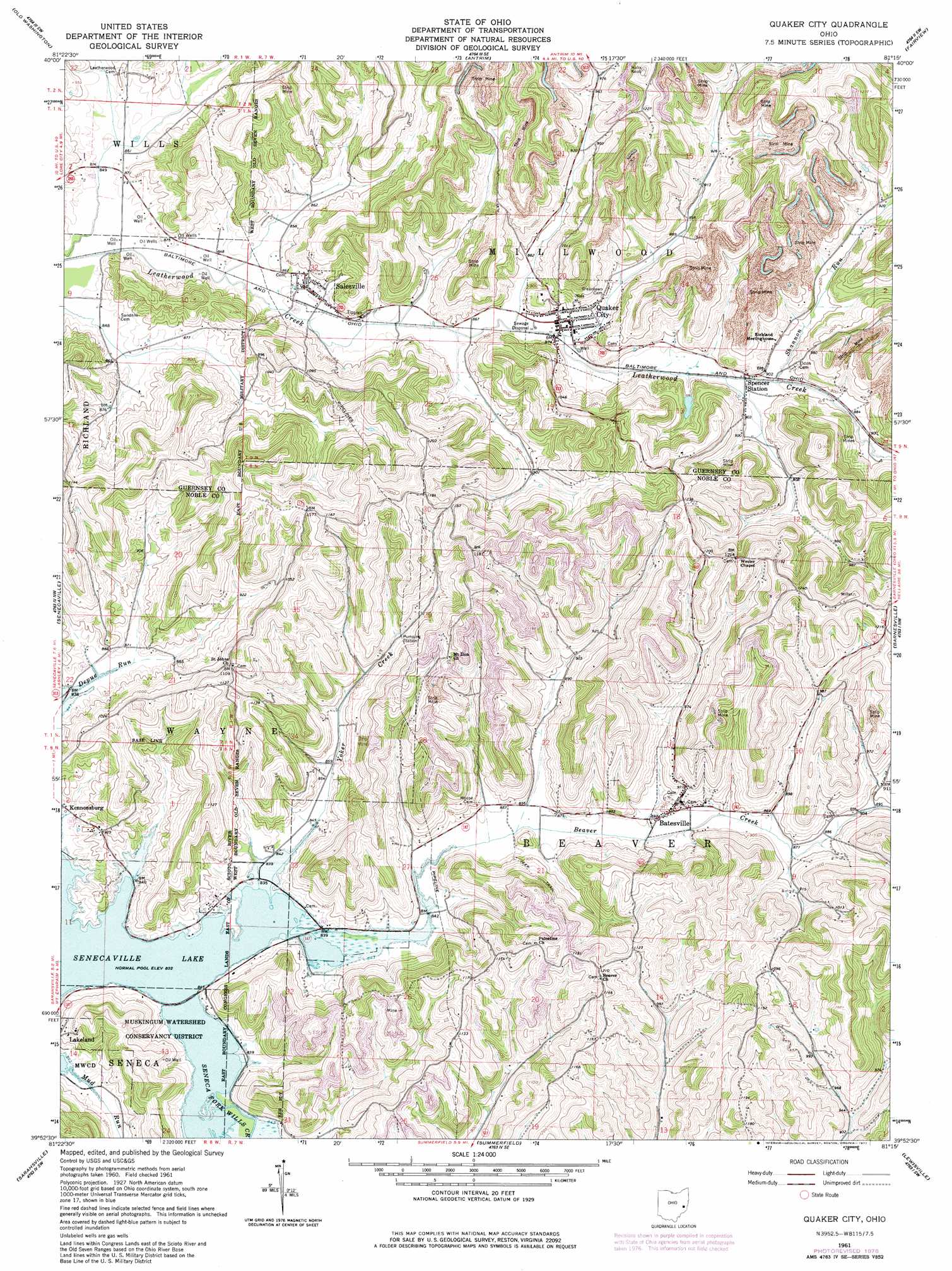
Quaker City Topo Map Ohio
To zoom in, hover over the map of Quaker City
USGS Topo Quad 39081h3 - 1:24,000 scale
| Topo Map Name: | Quaker City |
| USGS Topo Quad ID: | 39081h3 |
| Print Size: | ca. 21 1/4" wide x 27" high |
| Southeast Coordinates: | 39.875° N latitude / 81.25° W longitude |
| Map Center Coordinates: | 39.9375° N latitude / 81.3125° W longitude |
| U.S. State: | OH |
| Filename: | o39081h3.jpg |
| Download Map JPG Image: | Quaker City topo map 1:24,000 scale |
| Map Type: | Topographic |
| Topo Series: | 7.5´ |
| Map Scale: | 1:24,000 |
| Source of Map Images: | United States Geological Survey (USGS) |
| Alternate Map Versions: |
Quaker City OH 1961, updated 1963 Download PDF Buy paper map Quaker City OH 1961, updated 1977 Download PDF Buy paper map Quaker City OH 1994, updated 1998 Download PDF Buy paper map Quaker City OH 2010 Download PDF Buy paper map Quaker City OH 2013 Download PDF Buy paper map Quaker City OH 2016 Download PDF Buy paper map |
1:24,000 Topo Quads surrounding Quaker City
Kimbolton |
Birmingham |
Freeport |
Piedmont |
Flushing |
Cambridge |
Old Washington |
Antrim |
Fairview |
Bethesda |
Byesville |
Senecaville |
Quaker City |
Barnesville |
Hunter |
Caldwell North |
Sarahsville |
Summerfield |
Lewisville |
Woodsfield |
Caldwell South |
Macksburg |
Stafford |
Graysville |
Antioch |
> Back to 39081e1 at 1:100,000 scale
> Back to 39080a1 at 1:250,000 scale
> Back to U.S. Topo Maps home
Quaker City topo map: Gazetteer
Quaker City: Dams
B & O Railroad Pond Dam elevation 280m 918′Quaker City: Populated Places
Batesville elevation 277m 908′Lakeland elevation 287m 941′
Quaker City elevation 260m 853′
Salesville elevation 264m 866′
Spencer Station elevation 266m 872′
Sue-Lin Acres elevation 261m 856′
Quaker City: Post Offices
Batesville Post Office elevation 280m 918′Salesville Post Office elevation 263m 862′
Spencer's Station Post Office (historical) elevation 266m 872′
Quaker City: Reservoirs
B & O Railroad Pond elevation 280m 918′Quaker City: Streams
Beaver Creek elevation 252m 826′Glady Run elevation 245m 803′
Mud Run elevation 254m 833′
Shannon Run elevation 268m 879′
Yoker Creek elevation 253m 830′
Quaker City: Valleys
Yoker Valley elevation 254m 833′Quaker City digital topo map on disk
Buy this Quaker City topo map showing relief, roads, GPS coordinates and other geographical features, as a high-resolution digital map file on DVD:
 map DVD")