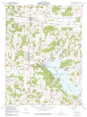
Senecaville Topo Map Ohio
To zoom in, hover over the map of Senecaville
USGS Topo Quad 39081h4 - 1:24,000 scale
| Topo Map Name: | Senecaville |
| USGS Topo Quad ID: | 39081h4 |
| Print Size: | ca. 21 1/4" wide x 27" high |
| Southeast Coordinates: | 39.875° N latitude / 81.375° W longitude |
| Map Center Coordinates: | 39.9375° N latitude / 81.4375° W longitude |
| U.S. State: | OH |
| Filename: | o39081h4.jpg |
| Download Map JPG Image: | Senecaville topo map 1:24,000 scale |
| Map Type: | Topographic |
| Topo Series: | 7.5´ |
| Map Scale: | 1:24,000 |
| Source of Map Images: | United States Geological Survey (USGS) |
| Alternate Map Versions: |
Senecaville OH 1961, updated 1963 Download PDF Buy paper map Senecaville OH 1961, updated 1972 Download PDF Buy paper map Senecaville OH 1961, updated 1977 Download PDF Buy paper map Senecaville OH 1994, updated 1998 Download PDF Buy paper map Senecaville OH 2010 Download PDF Buy paper map Senecaville OH 2013 Download PDF Buy paper map Senecaville OH 2016 Download PDF Buy paper map |
1:24,000 Topo Quads surrounding Senecaville
> Back to 39081e1 at 1:100,000 scale
> Back to 39080a1 at 1:250,000 scale
> Back to U.S. Topo Maps home
Senecaville topo map: Gazetteer
Senecaville: Dams
Camp Seneca Lake Dam elevation 244m 800′Robins Ridge Golf Club Dam Number One elevation 259m 849′
Robins Ridge Golf Club Dam Number Two elevation 268m 879′
Senecaville Dam elevation 254m 833′
Senecaville: Populated Places
Blacktop elevation 252m 826′Chaseville elevation 307m 1007′
Chestnut Grove Cottage Area elevation 261m 856′
Duch Addition elevation 262m 859′
East Shore Cottage Area elevation 272m 892′
Echo Point elevation 260m 853′
Gibson elevation 256m 839′
Greenwood elevation 257m 843′
Hickory Grove Cottage Area elevation 263m 862′
Kennonsburg elevation 268m 879′
Kings Mine elevation 259m 849′
Lakeview elevation 259m 849′
Lashley elevation 267m 875′
Lore City elevation 250m 820′
Mud Run elevation 279m 915′
New Gottingen elevation 316m 1036′
Noble Cottage Area elevation 265m 869′
Rose Addition elevation 267m 875′
Seneca Lake Estates elevation 274m 898′
Senecaville elevation 272m 892′
Walhonding elevation 250m 820′
West Shore Cottage Area elevation 262m 859′
Senecaville: Post Offices
ChasevillePost Office (historical) elevation 304m 997′Gibson Post Office (historical) elevation 256m 839′
Kennonsburg Post Office (historical) elevation 269m 882′
Lore City Post Office elevation 250m 820′
Senecaville Post Office elevation 274m 898′
Senecaville: Reservoirs
Camp Seneca Lake elevation 244m 800′Robins Ridge Golf Club Lake Number One elevation 259m 849′
Robins Ridge Golf Club Lake Number Two elevation 268m 879′
Senecaville Lake elevation 254m 833′
Senecaville: Streams
Depue Run elevation 252m 826′Hawkins Run elevation 244m 800′
Infirmary Run elevation 250m 820′
Opossum Run elevation 244m 800′
Senecaville digital topo map on disk
Buy this Senecaville topo map showing relief, roads, GPS coordinates and other geographical features, as a high-resolution digital map file on DVD:


