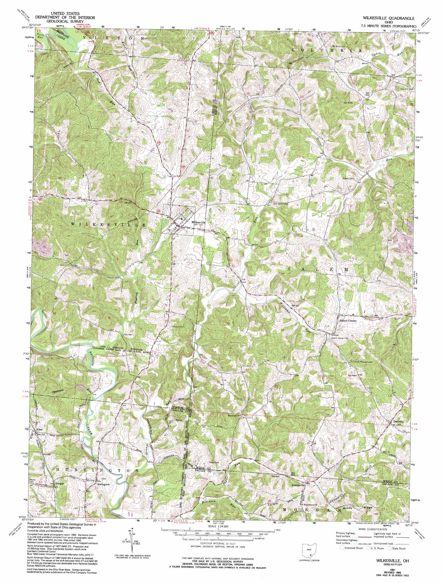
Wilkesville Topo Map Ohio
To zoom in, hover over the map of Wilkesville
USGS Topo Quad 39082a3 - 1:24,000 scale
| Topo Map Name: | Wilkesville |
| USGS Topo Quad ID: | 39082a3 |
| Print Size: | ca. 21 1/4" wide x 27" high |
| Southeast Coordinates: | 39° N latitude / 82.25° W longitude |
| Map Center Coordinates: | 39.0625° N latitude / 82.3125° W longitude |
| U.S. State: | OH |
| Filename: | o39082a3.jpg |
| Download Map JPG Image: | Wilkesville topo map 1:24,000 scale |
| Map Type: | Topographic |
| Topo Series: | 7.5´ |
| Map Scale: | 1:24,000 |
| Source of Map Images: | United States Geological Survey (USGS) |
| Alternate Map Versions: |
Wilkesville OH 1961, updated 1963 Download PDF Buy paper map Wilkesville OH 1961, updated 1972 Download PDF Buy paper map Wilkesville OH 1961, updated 1977 Download PDF Buy paper map Wilkesville OH 1961, updated 1995 Download PDF Buy paper map Wilkesville OH 2010 Download PDF Buy paper map Wilkesville OH 2013 Download PDF Buy paper map Wilkesville OH 2016 Download PDF Buy paper map |
1:24,000 Topo Quads surrounding Wilkesville
Allensville |
Zaleski |
Mineral |
The Plains |
Athens |
Hamden |
Mcarthur |
Vales Mills |
Albany |
Shade |
Wellston |
Mulga |
Wilkesville |
Rutland |
Pomeroy |
Oak Hill |
Rio Grande |
Vinton |
Addison |
Cheshire |
Gallia |
Patriot |
Rodney |
Gallipolis |
Beech Hill |
> Back to 39082a1 at 1:100,000 scale
> Back to 39082a1 at 1:250,000 scale
> Back to U.S. Topo Maps home
Wilkesville topo map: Gazetteer
Wilkesville: Populated Places
Alice elevation 219m 718′Danville elevation 232m 761′
Durgan elevation 207m 679′
Ewington elevation 207m 679′
Rowlesville elevation 210m 688′
Salem Center elevation 226m 741′
Wilkesville elevation 214m 702′
Wilkesville: Post Offices
Alice Post Office (historical) elevation 219m 718′Durgan Post Office (historical) elevation 206m 675′
Ewington Post Office elevation 207m 679′
Rowlesville Post Office (historical) elevation 208m 682′
Salem Center Post Office (historical) elevation 226m 741′
Wilkesville: Ridges
Windy Ridge elevation 248m 813′Wilkesville: Streams
Flatlick Run elevation 188m 616′Hog Run elevation 189m 620′
Opossum Run elevation 183m 600′
Pierce Run elevation 191m 626′
Strongs Run elevation 183m 600′
Sugar Run elevation 184m 603′
Williams Run elevation 199m 652′
Wilkesville digital topo map on disk
Buy this Wilkesville topo map showing relief, roads, GPS coordinates and other geographical features, as a high-resolution digital map file on DVD:
 map DVD")