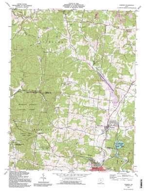
Hamden Topo Map Ohio
To zoom in, hover over the map of Hamden
USGS Topo Quad 39082b5 - 1:24,000 scale
| Topo Map Name: | Hamden |
| USGS Topo Quad ID: | 39082b5 |
| Print Size: | ca. 21 1/4" wide x 27" high |
| Southeast Coordinates: | 39.125° N latitude / 82.5° W longitude |
| Map Center Coordinates: | 39.1875° N latitude / 82.5625° W longitude |
| U.S. State: | OH |
| Filename: | o39082b5.jpg |
| Download Map JPG Image: | Hamden topo map 1:24,000 scale |
| Map Type: | Topographic |
| Topo Series: | 7.5´ |
| Map Scale: | 1:24,000 |
| Source of Map Images: | United States Geological Survey (USGS) |
| Alternate Map Versions: |
Hamden OH 1961, updated 1963 Download PDF Buy paper map Hamden OH 1961, updated 1977 Download PDF Buy paper map Hamden OH 1992, updated 1995 Download PDF Buy paper map Hamden OH 2010 Download PDF Buy paper map Hamden OH 2013 Download PDF Buy paper map Hamden OH 2016 Download PDF Buy paper map |
1:24,000 Topo Quads surrounding Hamden
> Back to 39082a1 at 1:100,000 scale
> Back to 39082a1 at 1:250,000 scale
> Back to U.S. Topo Maps home
Hamden topo map: Gazetteer
Hamden: Airports
Grant Lifeflight 2 Heliport elevation 221m 725′Hamden: Dams
Lake Alma Dam elevation 210m 688′Lake Rupert Dam elevation 215m 705′
Lankamer Lake Dam elevation 251m 823′
Wellston Reservoir Dam elevation 252m 826′
Hamden: Forests
Richland Furnace State Forest elevation 269m 882′Hamden: Lakes
Walleye Lake elevation 225m 738′Hamden: Parks
Lake Alma State Park elevation 210m 688′Wellston Reservoir State Wildlife Park elevation 215m 705′
Hamden: Populated Places
Glen Nell elevation 204m 669′Hamden elevation 220m 721′
Lesmil elevation 235m 770′
Richland elevation 204m 669′
Hamden: Reservoirs
Lake Alma elevation 210m 688′Lake Rupert elevation 215m 705′
Lankamer Lake elevation 251m 823′
Wellston Reservoir elevation 252m 826′
Hamden: Streams
Johnson Run elevation 213m 698′McConnel Run elevation 217m 711′
Sand Run elevation 200m 656′
Sugar Run elevation 206m 675′
Tripp Run elevation 206m 675′
Hamden: Trails
Acorn Trail elevation 234m 767′Old Pine Trail elevation 223m 731′
Hamden digital topo map on disk
Buy this Hamden topo map showing relief, roads, GPS coordinates and other geographical features, as a high-resolution digital map file on DVD:


