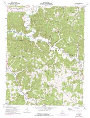
Byer Topo Map Ohio
To zoom in, hover over the map of Byer
USGS Topo Quad 39082b6 - 1:24,000 scale
| Topo Map Name: | Byer |
| USGS Topo Quad ID: | 39082b6 |
| Print Size: | ca. 21 1/4" wide x 27" high |
| Southeast Coordinates: | 39.125° N latitude / 82.625° W longitude |
| Map Center Coordinates: | 39.1875° N latitude / 82.6875° W longitude |
| U.S. State: | OH |
| Filename: | o39082b6.jpg |
| Download Map JPG Image: | Byer topo map 1:24,000 scale |
| Map Type: | Topographic |
| Topo Series: | 7.5´ |
| Map Scale: | 1:24,000 |
| Source of Map Images: | United States Geological Survey (USGS) |
| Alternate Map Versions: |
Byer OH 1961, updated 1963 Download PDF Buy paper map Byer OH 1961, updated 1974 Download PDF Buy paper map Byer OH 1961, updated 1976 Download PDF Buy paper map Byer OH 1961, updated 1990 Download PDF Buy paper map Byer OH 2010 Download PDF Buy paper map Byer OH 2013 Download PDF Buy paper map Byer OH 2016 Download PDF Buy paper map |
1:24,000 Topo Quads surrounding Byer
> Back to 39082a1 at 1:100,000 scale
> Back to 39082a1 at 1:250,000 scale
> Back to U.S. Topo Maps home
Byer topo map: Gazetteer
Byer: Bridges
Byer Bridge elevation 193m 633′Byer: Dams
Gallahan Pond Dam elevation 231m 757′Sproat Lake Dam elevation 192m 629′
Byer: Parks
Leo Petroglyph State Memorial elevation 221m 725′Byer: Populated Places
Bee (historical) elevation 211m 692′Byer elevation 195m 639′
Leo elevation 216m 708′
Pine Grove elevation 286m 938′
Ray elevation 181m 593′
Savageville elevation 187m 613′
Byer: Post Offices
Byer Post Office (historical) elevation 194m 636′Leo Post Office (historical) elevation 215m 705′
Byer: Reservoirs
Gallahan Pond elevation 231m 757′Sproat Lake elevation 192m 629′
Byer: Ridges
Fairview Ridge elevation 283m 928′Log Pile Ridge elevation 305m 1000′
Tick Ridge elevation 288m 944′
Byer: Streams
Glade Run elevation 196m 643′Long Branch elevation 184m 603′
Pigeon Creek elevation 181m 593′
Sour Run elevation 188m 616′
Spencer Run elevation 189m 620′
Byer: Valleys
Buttermilk Hollow elevation 188m 616′Davis Hollow elevation 183m 600′
Erwin Hollow elevation 182m 597′
George Hollow elevation 197m 646′
Good Hollow elevation 185m 606′
Louis Hollow elevation 201m 659′
Meadow Hollow elevation 229m 751′
Muskrat Hollow elevation 188m 616′
Parks Hollow elevation 206m 675′
Phillips Hollow elevation 183m 600′
Sandsuck Hollow elevation 178m 583′
Skunk Hollow elevation 191m 626′
Turkey Hollow elevation 187m 613′
Byer digital topo map on disk
Buy this Byer topo map showing relief, roads, GPS coordinates and other geographical features, as a high-resolution digital map file on DVD:


