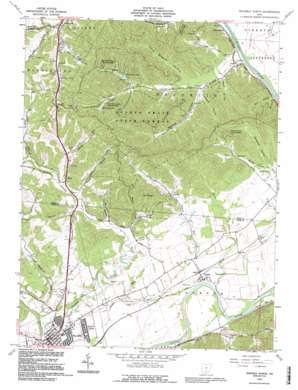
Waverly North Topo Map Ohio
To zoom in, hover over the map of Waverly North
USGS Topo Quad 39082b8 - 1:24,000 scale
| Topo Map Name: | Waverly North |
| USGS Topo Quad ID: | 39082b8 |
| Print Size: | ca. 21 1/4" wide x 27" high |
| Southeast Coordinates: | 39.125° N latitude / 82.875° W longitude |
| Map Center Coordinates: | 39.1875° N latitude / 82.9375° W longitude |
| U.S. State: | OH |
| Filename: | o39082b8.jpg |
| Download Map JPG Image: | Waverly North topo map 1:24,000 scale |
| Map Type: | Topographic |
| Topo Series: | 7.5´ |
| Map Scale: | 1:24,000 |
| Source of Map Images: | United States Geological Survey (USGS) |
| Alternate Map Versions: |
Waverly North OH 1961, updated 1963 Download PDF Buy paper map Waverly North OH 1961, updated 1972 Download PDF Buy paper map Waverly North OH 1961, updated 1977 Download PDF Buy paper map Waverly North OH 1961, updated 1992 Download PDF Buy paper map Waverly North OH 1992, updated 1995 Download PDF Buy paper map Waverly North OH 2010 Download PDF Buy paper map Waverly North OH 2013 Download PDF Buy paper map Waverly North OH 2016 Download PDF Buy paper map |
1:24,000 Topo Quads surrounding Waverly North
> Back to 39082a1 at 1:100,000 scale
> Back to 39082a1 at 1:250,000 scale
> Back to U.S. Topo Maps home
Waverly North topo map: Gazetteer
Waverly North: Airports
Pike County Airport elevation 201m 659′Waverly North: Areas
Pee Pee Prairie elevation 196m 643′Waverly North: Dams
Caldwell Lake Dam elevation 219m 718′Mead Foremens Club Pond Dam elevation 227m 744′
Stewart Lake Dam elevation 268m 879′
Waverly North: Lakes
Stewart Lake elevation 268m 879′Waverly North: Parks
Scioto Trail State Park elevation 220m 721′Waverly Canal Historic District elevation 180m 590′
Waverly North: Populated Places
Alma elevation 193m 633′Antonis elevation 202m 662′
Bristol Village elevation 180m 590′
Kilgore Estates elevation 191m 626′
Omega elevation 181m 593′
Pride elevation 179m 587′
Twin Mills Mobile Home Park elevation 208m 682′
Waverly elevation 181m 593′
Waverly Estates elevation 179m 587′
Waverly Heights elevation 184m 603′
Waverly North: Post Offices
Alma Post Office (historical) elevation 191m 626′Antonis Post Office (historical) elevation 221m 725′
Omega Post Office (historical) elevation 180m 590′
Pride Post Office (historical) elevation 182m 597′
Waverly Post Office elevation 181m 593′
Waverly North: Reservoirs
Caldwell Lake elevation 219m 718′Mead Foremens Club Pond elevation 227m 744′
Waverly North: Streams
Camp Run elevation 170m 557′Carrs Run elevation 170m 557′
Left Fork Crooked Creek elevation 173m 567′
Meadow Run elevation 171m 561′
Moore Run elevation 170m 557′
Moores Run elevation 183m 600′
Prussia Run elevation 175m 574′
Rozelle Creek elevation 201m 659′
Stony Creek elevation 176m 577′
Wilson Run elevation 170m 557′
Waverly North: Summits
Mount Pisgah elevation 309m 1013′Waverly North: Valleys
Ankrom Hollow elevation 186m 610′Back Hollow elevation 189m 620′
Bethel Hollow elevation 187m 613′
Cox Hollow elevation 232m 761′
DeBord Hollow elevation 205m 672′
Gee Hollow elevation 185m 606′
John George Hollow elevation 217m 711′
Long Branch Hollow elevation 193m 633′
Mill Hollow elevation 181m 593′
Opossum Hollow elevation 192m 629′
Rhine Hollow elevation 237m 777′
Webb Hollow elevation 182m 597′
Woods Hollow elevation 189m 620′
Waverly North digital topo map on disk
Buy this Waverly North topo map showing relief, roads, GPS coordinates and other geographical features, as a high-resolution digital map file on DVD:


