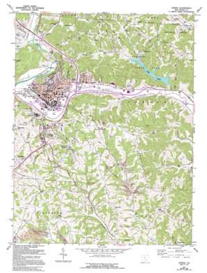
Athens Topo Map Ohio
To zoom in, hover over the map of Athens
USGS Topo Quad 39082c1 - 1:24,000 scale
| Topo Map Name: | Athens |
| USGS Topo Quad ID: | 39082c1 |
| Print Size: | ca. 21 1/4" wide x 27" high |
| Southeast Coordinates: | 39.25° N latitude / 82° W longitude |
| Map Center Coordinates: | 39.3125° N latitude / 82.0625° W longitude |
| U.S. State: | OH |
| Filename: | o39082c1.jpg |
| Download Map JPG Image: | Athens topo map 1:24,000 scale |
| Map Type: | Topographic |
| Topo Series: | 7.5´ |
| Map Scale: | 1:24,000 |
| Source of Map Images: | United States Geological Survey (USGS) |
| Alternate Map Versions: |
Athens OH 1961, updated 1962 Download PDF Buy paper map Athens OH 1961, updated 1966 Download PDF Buy paper map Athens OH 1961, updated 1976 Download PDF Buy paper map Athens OH 1961, updated 1985 Download PDF Buy paper map Athens OH 1961, updated 1985 Download PDF Buy paper map Athens OH 1961, updated 1995 Download PDF Buy paper map Athens OH 1961, updated 1995 Download PDF Buy paper map Athens OH 2002, updated 2005 Download PDF Buy paper map Athens OH 2011 Download PDF Buy paper map Athens OH 2013 Download PDF Buy paper map Athens OH 2016 Download PDF Buy paper map |
| FStopo: | US Forest Service topo Athens is available: Download FStopo PDF Download FStopo TIF |
1:24,000 Topo Quads surrounding Athens
> Back to 39082a1 at 1:100,000 scale
> Back to 39082a1 at 1:250,000 scale
> Back to U.S. Topo Maps home
Athens topo map: Gazetteer
Athens: Airports
McBee Heliport elevation 189m 620′Athens: Dams
Matters Pond Dam elevation 241m 790′Slater Brothers Pond Dam elevation 226m 741′
Strouds Run Dam elevation 207m 679′
Athens: Parks
Athens Downtown Historic District elevation 217m 711′Ohio University Campus Green Historic District elevation 219m 718′
Peden Stadium elevation 192m 629′
Strouds Run State Park elevation 214m 702′
Trautwein Field elevation 195m 639′
Athens: Populated Places
Armitage elevation 208m 682′Athens elevation 219m 718′
Carsey Town elevation 225m 738′
Clearview elevation 244m 800′
Elliottville elevation 231m 757′
Hickory Hills elevation 293m 961′
La Mar Heights elevation 199m 652′
Longview Heights elevation 306m 1003′
Lysander elevation 242m 793′
Valley View elevation 244m 800′
Wonder Hills elevation 239m 784′
Athens: Post Offices
Athens Post Office elevation 195m 639′Lysander Post Office (historical) elevation 243m 797′
Athens: Reservoirs
210 Reservoir elevation 207m 679′Dow Lake elevation 207m 679′
Margaret Creek Conservancy District Reservoir elevation 212m 695′
Margaret Creek Conservancy District Reservoir elevation 221m 725′
Matters Pond elevation 241m 790′
Slater Brothers Pond elevation 226m 741′
Athens: Ridges
Angel Ridge elevation 294m 964′Coolville Ridge elevation 289m 948′
Peach Ridge elevation 295m 967′
Scatter Ridge elevation 301m 987′
Athens: Streams
Cherry Creek elevation 192m 629′Coates Run elevation 194m 636′
Dairy Run elevation 195m 639′
Long Run elevation 218m 715′
Middle Branch Shade River elevation 221m 725′
Shade River elevation 213m 698′
Spring Branch elevation 241m 790′
Strouds Run elevation 188m 616′
Sugar Creek elevation 195m 639′
Tucker Run elevation 208m 682′
Athens: Summits
Chandlers Hill elevation 220m 721′Athens: Trails
Beaver Pond Trail elevation 227m 744′Broken Rock Trail elevation 299m 980′
Homestead Trail elevation 259m 849′
Indian Mound Trail elevation 226m 741′
Lakeview Trail elevation 205m 672′
Sycamore Valley Trail elevation 251m 823′
Athens: Valleys
Tucker Hollow elevation 203m 666′Athens digital topo map on disk
Buy this Athens topo map showing relief, roads, GPS coordinates and other geographical features, as a high-resolution digital map file on DVD:


