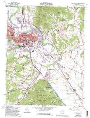
Chillicothe East Topo Map Ohio
To zoom in, hover over the map of Chillicothe East
USGS Topo Quad 39082c8 - 1:24,000 scale
| Topo Map Name: | Chillicothe East |
| USGS Topo Quad ID: | 39082c8 |
| Print Size: | ca. 21 1/4" wide x 27" high |
| Southeast Coordinates: | 39.25° N latitude / 82.875° W longitude |
| Map Center Coordinates: | 39.3125° N latitude / 82.9375° W longitude |
| U.S. State: | OH |
| Filename: | o39082c8.jpg |
| Download Map JPG Image: | Chillicothe East topo map 1:24,000 scale |
| Map Type: | Topographic |
| Topo Series: | 7.5´ |
| Map Scale: | 1:24,000 |
| Source of Map Images: | United States Geological Survey (USGS) |
| Alternate Map Versions: |
Chillicothe East OH 1961, updated 1963 Download PDF Buy paper map Chillicothe East OH 1961, updated 1970 Download PDF Buy paper map Chillicothe East OH 1961, updated 1972 Download PDF Buy paper map Chillicothe East OH 1961, updated 1976 Download PDF Buy paper map Chillicothe East OH 1961, updated 1985 Download PDF Buy paper map Chillicothe OH 1961, updated 1985 Download PDF Buy paper map Chillicothe East OH 1961, updated 1995 Download PDF Buy paper map Chillicothe East OH 2010 Download PDF Buy paper map Chillicothe East OH 2013 Download PDF Buy paper map Chillicothe East OH 2016 Download PDF Buy paper map |
1:24,000 Topo Quads surrounding Chillicothe East
> Back to 39082a1 at 1:100,000 scale
> Back to 39082a1 at 1:250,000 scale
> Back to U.S. Topo Maps home
Chillicothe East topo map: Gazetteer
Chillicothe East: Airports
District 9 Heliport elevation 186m 610′Veterans Administration Hospital Heliport elevation 195m 639′
Chillicothe East: Bends
Miller Cutoff elevation 189m 620′Chillicothe East: Dams
Knoles Pond Dam elevation 231m 757′Ross Lake Dam elevation 207m 679′
Chillicothe East: Forests
Scioto Trail State Forest elevation 237m 777′Chillicothe East: Parks
Great Seal State Park elevation 268m 879′Hopewell Culture National Historical Park elevation 195m 639′
Mary Lou Patton Park elevation 185m 606′
Mead Park elevation 185m 606′
Poland Park elevation 188m 616′
Ross County Lake State Wildlife Area elevation 244m 800′
Scioto River Canal Lands Access State Wildlife Area elevation 178m 583′
Story Mound State Memorial elevation 200m 656′
Youctangee Park elevation 187m 613′
Chillicothe East: Populated Places
Chillicothe elevation 192m 629′Deadman Crossing elevation 194m 636′
Eustis (historical) elevation 205m 672′
Franklin (historical) elevation 196m 643′
Jarvis elevation 227m 744′
Massieville elevation 188m 616′
Renick elevation 188m 616′
Renick Junction elevation 183m 600′
Riton (historical) elevation 189m 620′
Schrader elevation 184m 603′
Seymoreville (historical) elevation 187m 613′
Three Locks elevation 186m 610′
Vauces elevation 188m 616′
Chillicothe East: Post Offices
Chillicothe Post Office elevation 192m 629′Jarvis Post Office (historical) elevation 226m 741′
Chillicothe East: Reservoirs
Knoles Pond elevation 231m 757′Ross Lake elevation 207m 679′
Chillicothe East: Streams
Dry Run elevation 176m 577′Dry Run elevation 189m 620′
Indian Creek elevation 179m 587′
Lick Run elevation 181m 593′
North Branch Indian Creek elevation 189m 620′
Paint Creek elevation 180m 590′
Chillicothe East: Summits
Mount Ives elevation 351m 1151′Mount Logan elevation 378m 1240′
Rocky Knob elevation 390m 1279′
Chillicothe East: Valleys
Coon Hollow elevation 186m 610′Moss Hollow elevation 190m 623′
Snake Hollow elevation 182m 597′
Toad Hollow elevation 182m 597′
Chillicothe East digital topo map on disk
Buy this Chillicothe East topo map showing relief, roads, GPS coordinates and other geographical features, as a high-resolution digital map file on DVD:


