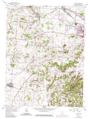
Amanda Topo Map Ohio
To zoom in, hover over the map of Amanda
USGS Topo Quad 39082f6 - 1:24,000 scale
| Topo Map Name: | Amanda |
| USGS Topo Quad ID: | 39082f6 |
| Print Size: | ca. 21 1/4" wide x 27" high |
| Southeast Coordinates: | 39.625° N latitude / 82.625° W longitude |
| Map Center Coordinates: | 39.6875° N latitude / 82.6875° W longitude |
| U.S. State: | OH |
| Filename: | o39082f6.jpg |
| Download Map JPG Image: | Amanda topo map 1:24,000 scale |
| Map Type: | Topographic |
| Topo Series: | 7.5´ |
| Map Scale: | 1:24,000 |
| Source of Map Images: | United States Geological Survey (USGS) |
| Alternate Map Versions: |
Amanda OH 1958, updated 1959 Download PDF Buy paper map Amanda OH 1958, updated 1972 Download PDF Buy paper map Amanda OH 1958, updated 1985 Download PDF Buy paper map Amanda OH 2010 Download PDF Buy paper map Amanda OH 2013 Download PDF Buy paper map Amanda OH 2016 Download PDF Buy paper map |
1:24,000 Topo Quads surrounding Amanda
> Back to 39082e1 at 1:100,000 scale
> Back to 39082a1 at 1:250,000 scale
> Back to U.S. Topo Maps home
Amanda topo map: Gazetteer
Amanda: Airports
Amanda Airport elevation 269m 882′Amanda: Bridges
Hutchins Bridge elevation 262m 859′Mink Hollow Bridge elevation 268m 879′
Rock Mill Bridge elevation 294m 964′
Amanda: Dams
Hunters Run Conservation District Structure Four Dam elevation 279m 915′Hunters Run Conservation District Structure One Dam elevation 306m 1003′
Hunters Run Conservation District Structure Three Dam elevation 275m 902′
Hunters Run Conservation District Structure Two Dam elevation 283m 928′
Moe Pond Dam elevation 336m 1102′
Amanda: Flats
Muddy Prairie elevation 278m 912′Amanda: Lakes
Triangle Lake elevation 252m 826′Amanda: Parks
Cedarlen Park elevation 265m 869′Christmas Rocks Nature Preserve elevation 350m 1148′
Lancaster Methodist Episcopal Camp Ground Historic District elevation 275m 902′
Rock Mill Dam State Wildlife Area elevation 281m 921′
Shallenberger State Nature Reserve elevation 291m 954′
Amanda: Populated Places
Amanda elevation 281m 921′Colonial Estates elevation 256m 839′
Delmont elevation 318m 1043′
Hamburg elevation 319m 1046′
Hooker elevation 258m 846′
Rock Mill elevation 304m 997′
Wesley Chapel elevation 315m 1033′
Amanda: Post Offices
Amanda Post Office elevation 282m 925′Camp Ground Post Office (historical) elevation 275m 902′
Delmont Post Office (historical) elevation 314m 1030′
Hamburg Post Office (historical) elevation 317m 1040′
Hooker Post Office (historical) elevation 257m 843′
Amanda: Reservoirs
Hunters Run Conservation District Structure Reservoir elevation 302m 990′Hunters Run Conservation District Structure Reservoir elevation 306m 1003′
Hunters Run Conservation District Structure Reservoir elevation 288m 944′
Hunters Run Conservation District Structure Reservoir elevation 283m 928′
Hunters Run Conservation District Structure Reservoir elevation 275m 902′
Hunters Run Conservation District Structure Reservoir elevation 279m 915′
Hunters Run Conservation District Structure Reservoir elevation 282m 925′
Moe Pond elevation 336m 1102′
Rock Mill Lake elevation 269m 882′
Amanda: Streams
Black Run elevation 262m 859′Crumley Creek elevation 277m 908′
Dunkle Run elevation 262m 859′
Greenfield Creek elevation 252m 826′
Stonewall Creek elevation 262m 859′
Wilson Creek elevation 270m 885′
Amanda: Summits
Allen Knob elevation 344m 1128′Becks Knob elevation 339m 1112′
Christmas Rocks elevation 346m 1135′
Claypool Knob elevation 330m 1082′
Jacobs Ladder elevation 361m 1184′
Ruble Knob elevation 319m 1046′
Sand Hill elevation 332m 1089′
Stony Hill elevation 305m 1000′
Amanda: Valleys
Oil Mill Hollow elevation 264m 866′Pleasant Valley elevation 278m 912′
Amanda digital topo map on disk
Buy this Amanda topo map showing relief, roads, GPS coordinates and other geographical features, as a high-resolution digital map file on DVD:


